
File:Legume Biogeography.svg

Size of this PNG preview of this SVG file: 800 × 445 pixels. Other resolutions: 320 × 178 pixels | 640 × 356 pixels | 1,024 × 570 pixels | 1,280 × 712 pixels | 2,560 × 1,424 pixels | 4,378 × 2,435 pixels.
Original file (SVG file, nominally 4,378 × 2,435 pixels, file size: 1.19 MB)
| This is a file from the Wikimedia Commons. Information from its description page there is shown below. Commons is a freely licensed media file repository. You can help. |
| Description |
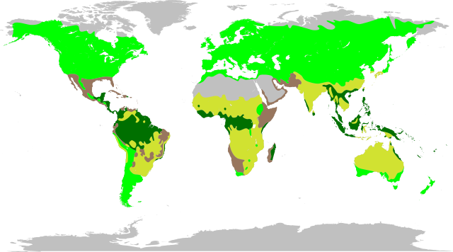
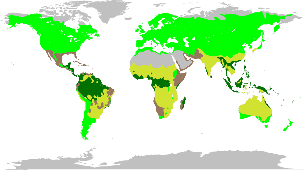
English: The major legume biomes, according to The Royal Botanic Gardens, Kew. Because the original map from The Royal Botanic Gardens, Kew and File:World map blank without borders.svg use different map projections, some ambiguity was introduced into this map. Thus it can only be taken to represent basic trends in legume biomes, not precise boundaries.
|
|
| Date | (UTC) | |
| Source | ||
| Author |
|
I, the copyright holder of this work, hereby publish it under the following licenses:
This file is licensed under the Creative Commons Attribution-Share Alike 3.0 Unported, 2.5 Generic, 2.0 Generic and 1.0 Generic license.
- You are free:
- to share – to copy, distribute and transmit the work
- to remix – to adapt the work
- Under the following conditions:
- attribution – You must give appropriate credit, provide a link to the license, and indicate if changes were made. You may do so in any reasonable manner, but not in any way that suggests the licensor endorses you or your use.
- share alike – If you remix, transform, or build upon the material, you must distribute your contributions under the same or compatible license as the original.

|
Permission is granted to copy, distribute and/or modify this document under the terms of the GNU Free Documentation License, Version 1.2 or any later version published by the Free Software Foundation; with no Invariant Sections, no Front-Cover Texts, and no Back-Cover Texts. A copy of the license is included in the section entitled GNU Free Documentation License. |
You may select the license of your choice.
Original upload log
This image is a derivative work of the following images:
- File:World_map_blank_without_borders.svg licensed with Cc-by-sa-3.0,2.5,2.0,1.0, GFDL
- 2009-01-28T19:55:29Z Phirosiberia 4378x2435 (953484 Bytes) Only one object
- 2009-01-27T20:00:27Z Phirosiberia 760x360 (875550 Bytes) {{Information |Description={{en|1=World map blank without borders.}} {{es|1=Mapa del mundo e blanco y sin fronteras dibujadas.}} |Source=trabajo propio (own work) |Author=[[User:Crates|Crates]] |Date=2009-01-27 |Permission= |
Uploaded with derivativeFX
File history
Click on a date/time to view the file as it appeared at that time.
| Date/Time | Thumbnail | Dimensions | User | Comment | |
|---|---|---|---|---|---|
| current | 14:50, 21 July 2010 | | 4,378 × 2,435 (1.19 MB) | Ninjatacoshell | {{Information |Description={{en|1=The major legume biomes, according to [http://www.kew.org/science/directory/projects/BiogeogLegumes.html The Royal Botanic Gardens, Kew]. Because the original map from [http://www.kew.org/science/directory/projects/Biogeo |
File usage
The following pages on the English Wikipedia use this file (pages on other projects are not listed):
Global file usage
The following other wikis use this file:
- Usage on af.wikipedia.org
- Usage on ar.wikipedia.org
- Usage on arz.wikipedia.org
- Usage on ast.wikipedia.org
- Usage on be.wikipedia.org
- Usage on bg.wikipedia.org
- Usage on bn.wikipedia.org
- Usage on bs.wikipedia.org
- Usage on ca.wikipedia.org
- Usage on cs.wikipedia.org
- Usage on eo.wikipedia.org
- Usage on eu.wikipedia.org
- Usage on fa.wikipedia.org
- Usage on he.wikipedia.org
- Usage on hr.wikipedia.org
- Usage on hu.wikipedia.org
- Usage on hy.wikipedia.org
- Usage on ia.wikipedia.org
- Usage on id.wikipedia.org
- Usage on ilo.wikipedia.org
- Usage on kk.wikipedia.org
- Usage on kn.wikipedia.org
- Usage on ku.wikipedia.org
- Usage on mk.wikipedia.org
- Usage on mn.wikipedia.org
- Usage on nn.wikipedia.org
- Usage on pnb.wikipedia.org
- Usage on pt.wikipedia.org
- Usage on ro.wikipedia.org
- Usage on sco.wikipedia.org
- Usage on sh.wikipedia.org
- Usage on sr.wikipedia.org
- Usage on sv.wikipedia.org
- Usage on ta.wikipedia.org
- Usage on th.wikipedia.org
- Usage on tr.wikipedia.org
- Usage on vep.wikipedia.org
- Usage on vi.wikipedia.org
- Usage on www.wikidata.org
- Usage on zh.wikipedia.org