
File:Le palais morbihan citadelle vauban 2011e.jpg
Size of this preview: 800 × 450 pixels. Other resolutions: 320 × 180 pixels | 640 × 360 pixels | 1,024 × 575 pixels | 1,280 × 719 pixels | 3,000 × 1,686 pixels.
Original file (3,000 × 1,686 pixels, file size: 2.45 MB, MIME type: image/jpeg)
| This is a file from the Wikimedia Commons. Information from its description page there is shown below. Commons is a freely licensed media file repository. You can help. |
Summary
| Description |
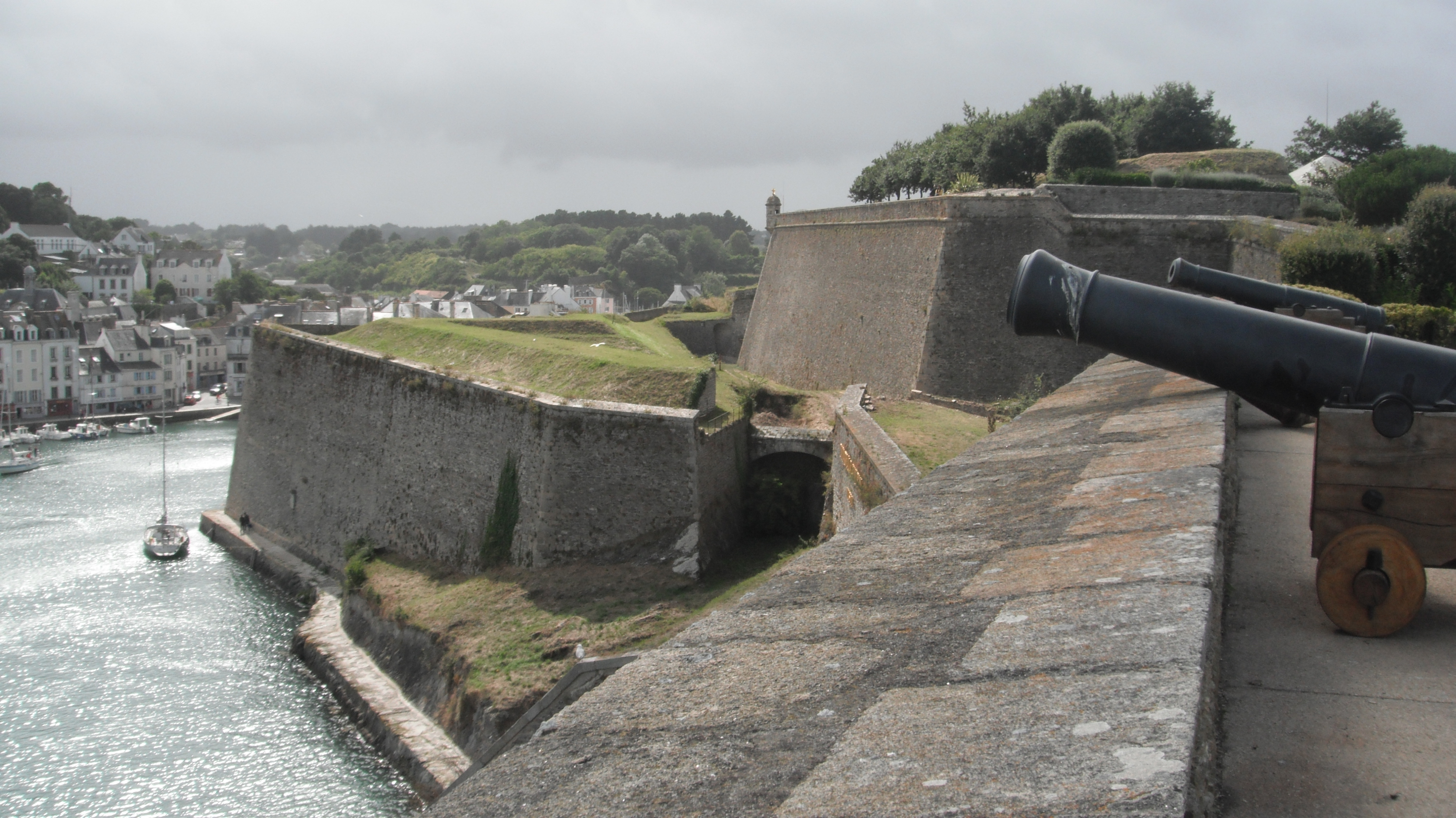
Français : Fortifications de la citadelle Vauban de Le Palais (Belle-Île-en-Mer, Morbihan, France), juillet 2011. Ensemble situé au lieu-dit Haute-Boulogne, bâti du XVIe au XIXe siècle, classé aux Monuments historiques. Voir aussi autre cliché.
English: The Citadel Vauban.
Deutsch: Die Zitadelle von Vauban. |
| Date | |
| Source | Own work |
| Author | Franck-fnba |
| Object location | | View this and other nearby images on: OpenStreetMap |
|---|
|
This building is en partie classé, en partie inscrit au titre des monuments historiques de la France. It is indexed in the base Mérimée, a database of architectural heritage maintained by the French Ministry of Culture, under the reference PA00091470
|
Licensing
I, the copyright holder of this work, hereby publish it under the following license:
This file is licensed under the Creative Commons Attribution-Share Alike 4.0 International license.
- You are free:
- to share – to copy, distribute and transmit the work
- to remix – to adapt the work
- Under the following conditions:
- attribution – You must give appropriate credit, provide a link to the license, and indicate if changes were made. You may do so in any reasonable manner, but not in any way that suggests the licensor endorses you or your use.
- share alike – If you remix, transform, or build upon the material, you must distribute your contributions under the same or compatible license as the original.
File history
Click on a date/time to view the file as it appeared at that time.
| Date/Time | Thumbnail | Dimensions | User | Comment | |
|---|---|---|---|---|---|
| current | 16:38, 28 June 2015 | | 3,000 × 1,686 (2.45 MB) | Franck-fnba | User created page with UploadWizard |
File usage
The following pages on the English Wikipedia use this file (pages on other projects are not listed):
Global file usage
The following other wikis use this file:
- Usage on es.wikipedia.org
- Usage on it.wikipedia.org