
File:Land cover IGBP.png
Size of this preview: 800 × 400 pixels. Other resolutions: 320 × 160 pixels | 640 × 320 pixels | 1,024 × 512 pixels | 1,280 × 640 pixels | 3,600 × 1,800 pixels.
Original file (3,600 × 1,800 pixels, file size: 1.79 MB, MIME type: image/png)
| This is a file from the Wikimedia Commons. Information from its description page there is shown below. Commons is a freely licensed media file repository. You can help. |
Summary
| Description |
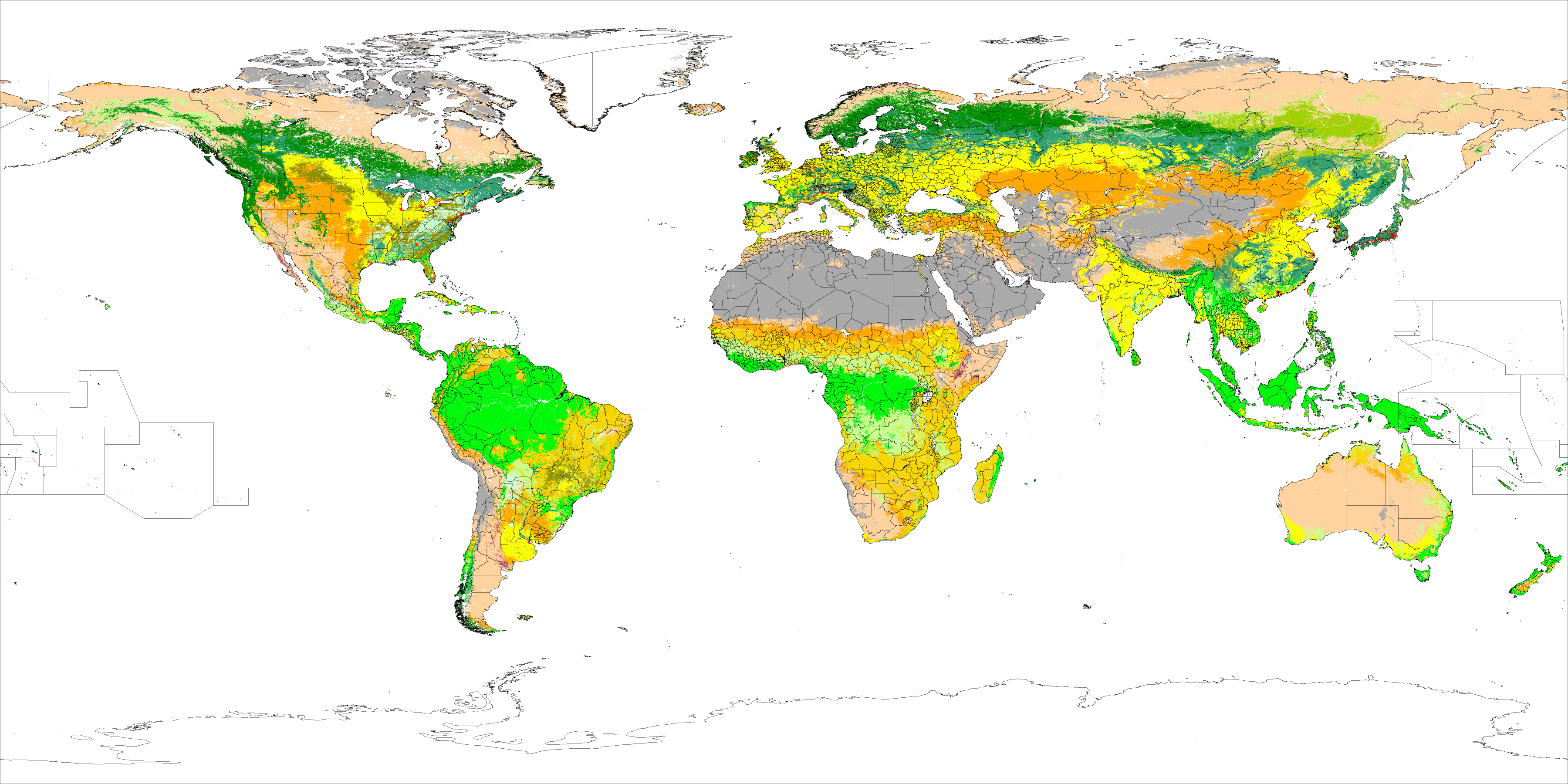
English: MOD12C1 17 land cover classes defined by the International Geosphere Biosphere Programme (IGBP)
Class definition[1] Color Code[2] Water
Evergreen Needleleaf Forest
Evergreen Broadleaf Forest
Deciduous Needleleaf Forest
Deciduous Broadleaf Forest
Mixed Forest
Closed Shrubland
Open Shrubland
Woody Savannas
Savannas
Grasslands
Permanent Wetlands
Croplands
Urban and Built-Up
Cropland/Natural Vegetation Mosaic
Snow and Ice
Barren or Sparsely Vegetated |
| Date | between 2001 and 2004 |
| Source | https://lpdaac.usgs.gov/lpdaac/products/modis_products_table/land_cover/yearly_l3_global_0_05deg_cmg/mod12c1 |
| Author | T. Hengl |
File description: http://spatial-analyst.net/worldmaps/IGBP.rdc
Licensing
This file is licensed under the Creative Commons Attribution-Share Alike 3.0 Unported license.
- You are free:
- to share – to copy, distribute and transmit the work
- to remix – to adapt the work
- Under the following conditions:
- attribution – You must give appropriate credit, provide a link to the license, and indicate if changes were made. You may do so in any reasonable manner, but not in any way that suggests the licensor endorses you or your use.
- share alike – If you remix, transform, or build upon the material, you must distribute your contributions under the same or compatible license as the original.
- ↑ The IGBP Land Cover Classification
- ↑ The Land Processes Distributed Active Archive Center (LP DAAC) MODIS/Terra Land Cover Types Yearly L3 Global 0.05Deg CMG (MOD12C1)
File history
Click on a date/time to view the file as it appeared at that time.
| Date/Time | Thumbnail | Dimensions | User | Comment | |
|---|---|---|---|---|---|
| current | 09:28, 1 April 2010 | | 3,600 × 1,800 (1.79 MB) | Hengl | Reduced size 50% |
| 23:24, 31 March 2010 |  | 7,200 × 3,600 (2.2 MB) | Hengl | {{Information |Description={{en|1=MOD12C1 17 land cover classes defined by the International Geosphere Biosphere Programme (IGBP) }} |Source=https://lpdaac.usgs.gov/lpdaac/products/modis_products_table/land_cover/yearly_l3_global_0_05deg_cmg/mod12c1 |Auth |
File usage
The following pages on the English Wikipedia use this file (pages on other projects are not listed):
Global file usage
The following other wikis use this file:
- Usage on es.wikipedia.org
- Usage on fr.wikipedia.org
- Usage on ja.wikipedia.org
- Usage on no.wikipedia.org
- Usage on ru.wikipedia.org
- Usage on www.wikidata.org