
File:Koufonisi Aerial Photo.jpg

Size of this preview: 800 × 533 pixels. Other resolutions: 320 × 213 pixels | 640 × 426 pixels | 1,024 × 682 pixels | 1,280 × 853 pixels | 3,002 × 2,000 pixels.
Original file (3,002 × 2,000 pixels, file size: 1.79 MB, MIME type: image/jpeg)
| This is a file from the Wikimedia Commons. Information from its description page there is shown below. Commons is a freely licensed media file repository. You can help. |
Summary
| Description |
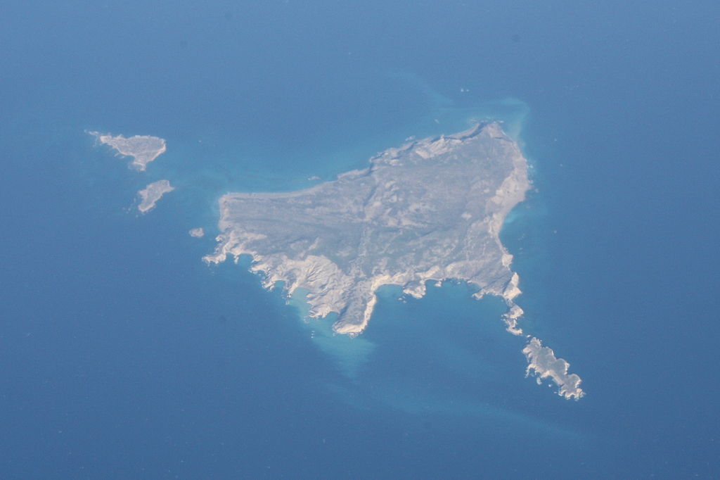
English: Aerial Photo of the uninhabited island Koufonisi close to Crete, Greece
Deutsch: Luftbild der unbewohnten Insel Koufonisi vor der Küste Kretas, Griechenland
Svenska: Flygfoto av ön Koufonisi på Kretas kust, Grekland |
| Date | |
| Source | Own work |
| Author | Hansbaer |
| Camera location | | View this and other nearby images on: OpenStreetMap |
|---|
Shot from an Ethiopian Airlines flight from Addis Ababa to Frankfurt
Licensing
I, the copyright holder of this work, hereby publish it under the following licenses:
This file is licensed under the Creative Commons Attribution-Share Alike 3.0 Unported license.
- You are free:
- to share – to copy, distribute and transmit the work
- to remix – to adapt the work
- Under the following conditions:
- attribution – You must give appropriate credit, provide a link to the license, and indicate if changes were made. You may do so in any reasonable manner, but not in any way that suggests the licensor endorses you or your use.
- share alike – If you remix, transform, or build upon the material, you must distribute your contributions under the same or compatible license as the original.

|
Permission is granted to copy, distribute and/or modify this document under the terms of the GNU Free Documentation License, Version 1.2 or any later version published by the Free Software Foundation; with no Invariant Sections, no Front-Cover Texts, and no Back-Cover Texts. A copy of the license is included in the section entitled GNU Free Documentation License. |
You may select the license of your choice.
File history
Click on a date/time to view the file as it appeared at that time.
| Date/Time | Thumbnail | Dimensions | User | Comment | |
|---|---|---|---|---|---|
| current | 19:06, 27 May 2011 | | 3,002 × 2,000 (1.79 MB) | Hansbaer | {{Information |Description ={{en|1=Aerial Photo of the uninhabited island Koufonisi close to Crete, Greece}} {{de|1=Luftbild der unbewohnten Insel Koufonisi vor der Küste Kretas, Griechenland}} {{sv|1=Flygfoto av ön Koufonisi på Kretas kust, Greklan |
File usage
The following pages on the English Wikipedia use this file (pages on other projects are not listed):
Global file usage
The following other wikis use this file:
- Usage on ca.wikipedia.org
- Usage on ceb.wikipedia.org
- Usage on de.wikipedia.org
- Usage on de.wikivoyage.org
- Usage on el.wikipedia.org
- Usage on es.wikipedia.org
- Usage on fi.wikipedia.org
- Usage on fr.wikipedia.org
- Usage on it.wikivoyage.org
- Usage on pl.wikipedia.org
- Usage on ru.wikipedia.org
- Usage on sr.wikipedia.org
- Usage on sv.wikipedia.org
- Usage on tr.wikipedia.org
- Usage on ur.wikipedia.org
- Usage on www.wikidata.org
- Usage on zh.wikipedia.org