
File:Kinross parishes.png
No higher resolution available.
Kinross_parishes.png (550 × 350 pixels, file size: 9 KB, MIME type: image/png)
| This is a file from the Wikimedia Commons. Information from its description page there is shown below. Commons is a freely licensed media file repository. You can help. |
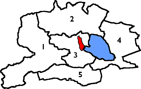
| Description | Cleish, Orwell (containing the market town of Milnathort), Kinross and Portmoak were entirely in Kinross-shire. The parishes of Arngask, Fossoway and Tulliebole and Forgandenny were partly in Perthshire. From 1845 they were used for local government purposes and governed by parochial boards. |
| Date | 22 January 2007 (original upload date) |
| Source | Transferred from en.wikipedia to Commons by Quadell using CommonsHelper. |
| Author | Lozleader at English Wikipedia |
Licensing
| This file is licensed under the Creative Commons Attribution-Share Alike 3.0 Unported license. Subject to disclaimers. | ||
| ||
| This licensing tag was added to this file as part of the GFDL licensing update. |
Lozleader at the English-language Wikipedia, the copyright holder of this work, hereby publishes it under the following license:
| This file is licensed under the Creative Commons Attribution-Share Alike 3.0 Unported license. Subject to disclaimers. | ||
| Attribution: Lozleader at the English-language Wikipedia | ||
| ||
| This licensing tag was added to this file as part of the GFDL licensing update. |

|
Permission is granted to copy, distribute and/or modify this document under the terms of the GNU Free Documentation License, Version 1.2 or any later version published by the Free Software Foundation; with no Invariant Sections, no Front-Cover Texts, and no Back-Cover Texts. A copy of the license is included in the section entitled GNU Free Documentation License. Subject to disclaimers. |
Original upload log
The original description page was here. All following user names refer to en.wikipedia.
- 2007-01-22 17:43 Tene 550×350× (9393 bytes) Optimised (no filter, 128b block split)
- 2007-01-16 22:38 Lozleader 550×350× (15421 bytes) Map of the [[civil parish]]es of [[Kinross-shire]] c [[1891]] - [[1975]].
File history
Click on a date/time to view the file as it appeared at that time.
| Date/Time | Thumbnail | Dimensions | User | Comment | |
|---|---|---|---|---|---|
| current | 03:17, 20 June 2009 | | 550 × 350 (9 KB) | File Upload Bot (Magnus Manske) | {{BotMoveToCommons|en.wikipedia|year={{subst:CURRENTYEAR}}|month={{subst:CURRENTMONTHNAME}}|day={{subst:CURRENTDAY}}}} {{Information |Description={{en|Map of the en:civil parishes of en:Kinross-shire c en:1891 - en:1975.}} |Source |
File usage
The following pages on the English Wikipedia use this file (pages on other projects are not listed):