
File:Karte Siboga-Expedition.jpg
Original file (1,360 × 954 pixels, file size: 1.18 MB, MIME type: image/jpeg)
| This is a file from the Wikimedia Commons. Information from its description page there is shown below. Commons is a freely licensed media file repository. You can help. |
Summary
| Description |
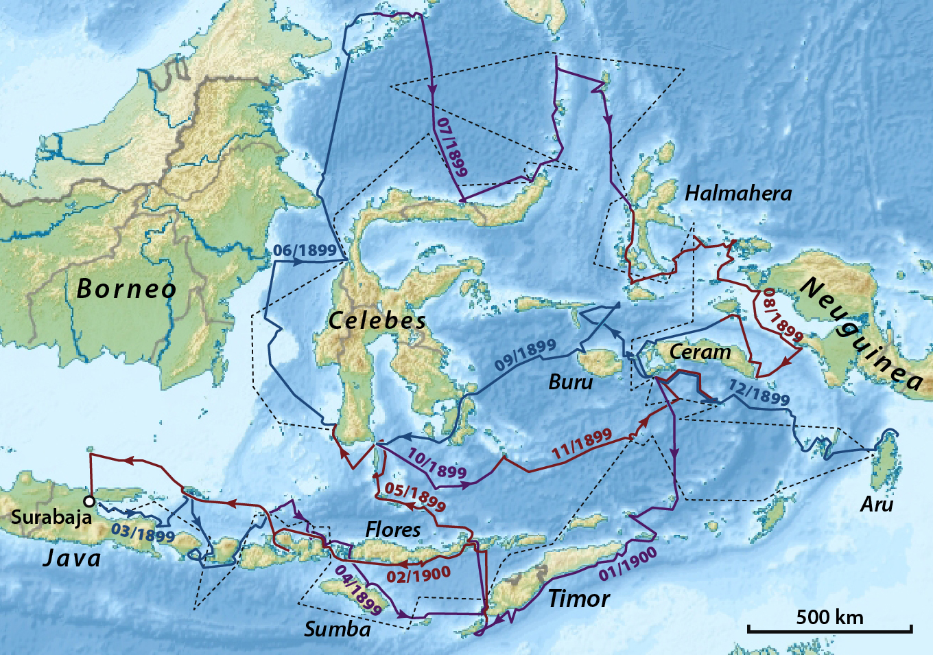
Deutsch: Route der Siboga-Expedition; schwarz=geplante Route von 1898; farbig=tatsächlicher Expeditions-Verlauf 1899–1900
English: Route of the Siboga-Expedition; black=proposed route from 1898; coloured=course of the expedition 1899–1900 |
| Date | |
| Source |
Own work using:
|
| Author | NordNordWest |

|
This map has been made or improved in the German Kartenwerkstatt (Map Lab). You can propose maps to improve as well.
|
Licensing
Usage of this file with:

explanatory notes: Legally binding is only the full legalcode. For a free usage I recommend to respect the following licence conditions:
1. Provide my name as given above: NordNordWest,
2. a copy of, or the URI for, the applicable license: https://creativecommons.org/licenses/by-sa/3.0/de/legalcode,
3. the title of the work,
4. in the case of an adaptation, a credit identifying the use of the work in the adaptation.
This license and the rights granted hereunder will terminate automatically upon any breach by you of the terms of this license. Any of the above conditions can be waived if you get permission from the copyright holder. If you have questions or wish differing conditions, please contact me through nnwest or my discussion page ![]() t-online.de
t-online.de
- You are free:
- to share – to copy, distribute and transmit the work
- to remix – to adapt the work
- Under the following conditions:
- attribution – You must give appropriate credit, provide a link to the license, and indicate if changes were made. You may do so in any reasonable manner, but not in any way that suggests the licensor endorses you or your use.
- share alike – If you remix, transform, or build upon the material, you must distribute your contributions under the same or compatible license as the original.

File history
Click on a date/time to view the file as it appeared at that time.
| Date/Time | Thumbnail | Dimensions | User | Comment | |
|---|---|---|---|---|---|
| current | 09:15, 6 June 2014 | | 1,360 × 954 (1.18 MB) | NordNordWest | c |
| 08:05, 6 May 2014 |  | 1,360 × 954 (1.19 MB) | NordNordWest | upd | |
| 13:02, 4 May 2014 |  | 1,360 × 954 (1.18 MB) | NordNordWest | upd | |
| 16:30, 24 March 2014 |  | 654 × 459 (390 KB) | NordNordWest | c | |
| 09:34, 17 March 2014 |  | 654 × 459 (388 KB) | NordNordWest | c | |
| 19:39, 14 March 2014 |  | 654 × 459 (386 KB) | NordNordWest | == {{int:filedesc}} == {{Information |Description= {{de|1=Route der Siboga-Expedition 1899–1900; schwarz=geplante Route; rot=tatsächliche Route}} |Source={{Own using}} * File:Indonesia relief location map.jpg by {{U|Uw... |
File usage
Global file usage
The following other wikis use this file:
- Usage on de.wikipedia.org
- Usage on fr.wikipedia.org
- Usage on id.wikipedia.org
- Usage on nl.wikipedia.org
- Usage on www.wikidata.org