
File:Karte Burgasseen.svg

Size of this PNG preview of this SVG file: 751 × 600 pixels. Other resolutions: 301 × 240 pixels | 601 × 480 pixels | 962 × 768 pixels | 1,280 × 1,022 pixels | 2,560 × 2,045 pixels | 1,282 × 1,024 pixels.
Original file (SVG file, nominally 1,282 × 1,024 pixels, file size: 751 KB)
| This is a file from the Wikimedia Commons. Information from its description page there is shown below. Commons is a freely licensed media file repository. You can help. |
Summary
| Description |
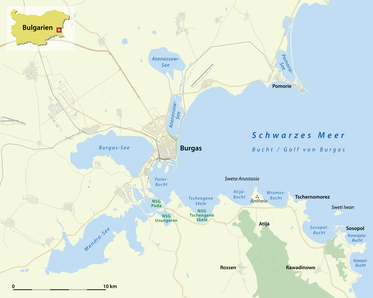
Deutsch: Karte der Burgasseen, Bulgarien
English: Map of the lakes near Burgas, Bulgaria |
||||||||||||
| Date | |||||||||||||
| Source | Own work | ||||||||||||
| Author | NordNordWest | ||||||||||||
| Permission (Reusing this file) |
|
||||||||||||
| Other versions |
Derivative works of this file: Derivative works of this file: Karte Burgasseen-3.jpg |

|
This map has been made or improved in the German Kartenwerkstatt (Map Lab). You can propose maps to improve as well.
|
File history
Click on a date/time to view the file as it appeared at that time.
| Date/Time | Thumbnail | Dimensions | User | Comment | |
|---|---|---|---|---|---|
| current | 17:28, 5 November 2012 | | 1,282 × 1,024 (751 KB) | NordNordWest | upd |
| 18:04, 9 February 2012 |  | 1,282 × 1,024 (714 KB) | NordNordWest | upd | |
| 19:18, 28 January 2011 |  | 1,282 × 1,024 (685 KB) | NordNordWest | upd | |
| 20:11, 6 November 2010 |  | 1,282 × 1,024 (685 KB) | NordNordWest | =={{int:filedesc}}== {{Information |Description= {{de|Karte der Burgasseen, Bulgarien}} {{en|Map of the lakes near Burgas, Bulgaria}} |Source={{Own}} |Date=2010-11-06 |Author={{U|NordNordWest}} |Permission={{OpenStreetMap}} |other_vers |
File usage
The following pages on the English Wikipedia use this file (pages on other projects are not listed):
Global file usage
The following other wikis use this file:
- Usage on bg.wikipedia.org
- Usage on cs.wikipedia.org
- Usage on de.wikipedia.org
- Schwarzes Meer
- Oblast Burgas
- Sweta Anastasia
- Sweti Iwan
- Atanassow-See
- Mandra-See
- Burgas-See
- Pomorie-See
- Naturschutzgebiet Poda
- Burgasseen
- Bucht von Burgas
- Wikipedia:Kartenwerkstatt/Archiv/2010-11
- Naturschutzgebiet Tschengene Skele
- Tschengene Skele (Bucht)
- Naturschutzgebiet Usungeren
- Antheia (Thrakien)
- Wikipedia:Kartenwerkstatt/Archiv/2012-11
- Usage on de.wikivoyage.org
- Usage on eo.wikivoyage.org
- Usage on es.wikipedia.org
- Usage on fr.wikipedia.org
- Usage on hu.wikipedia.org
- Usage on nl.wikipedia.org
- Usage on pl.wiktionary.org
- Usage on rm.wikipedia.org
- Usage on ro.wikipedia.org
- Usage on sv.wikipedia.org
- Usage on uk.wikipedia.org
- Usage on www.wikidata.org