
File:KRHV airport diagram.png
Size of this preview: 391 × 600 pixels. Other resolutions: 156 × 240 pixels | 313 × 480 pixels | 500 × 768 pixels | 667 × 1,024 pixels | 1,613 × 2,475 pixels.
Original file (1,613 × 2,475 pixels, file size: 116 KB, MIME type: image/png)
| This is a file from the Wikimedia Commons. Information from its description page there is shown below. Commons is a freely licensed media file repository. You can help. |
Summary
| Description |
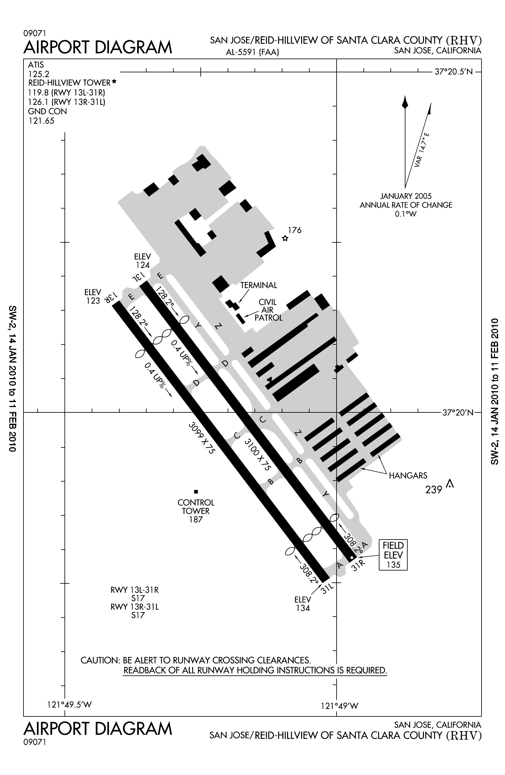
English: FAA airport diagram for KRHV (Reid-Hillview Airport of Santa Clara County) in California, United States |
| Date | |
| Source | http://aeronav.faa.gov/d-tpp/1510/05591ad.pdf |
| Author | Federal Aviation Administration, National Aviation Charting Office (NACO) |
Licensing
This image or file is a work of a Federal Aviation Administration employee, taken or made as part of that person's official duties. As a work of the U.S. federal government, the image is in the public domain in the United States.
|
 |
File history
Click on a date/time to view the file as it appeared at that time.
| Date/Time | Thumbnail | Dimensions | User | Comment | |
|---|---|---|---|---|---|
| current | 02:55, 25 January 2010 | | 1,613 × 2,475 (116 KB) | Ikluft | {{Information |Description={{en|1=FAA airport diagram for KRHV (Reid-Hillview Airport of Santa Clara County) in California, United States}} |Source=http://naco.faa.gov/d-tpp/1001/05591AD.PDF |Author=[[w:Federal Aviation Adminis |
File usage
The following pages on the English Wikipedia use this file (pages on other projects are not listed):
Global file usage
The following other wikis use this file:
- Usage on fa.wikipedia.org
- Usage on tg.wikipedia.org
- Usage on ur.wikipedia.org