
File:Italy and Illyria 1084 AD.svg

Size of this PNG preview of this SVG file: 478 × 600 pixels. Other resolutions: 191 × 240 pixels | 383 × 480 pixels | 612 × 768 pixels | 816 × 1,024 pixels | 1,633 × 2,048 pixels | 586 × 735 pixels.
Original file (SVG file, nominally 586 × 735 pixels, file size: 522 KB)
| This is a file from the Wikimedia Commons. Information from its description page there is shown below. Commons is a freely licensed media file repository. You can help. |

Summary
| Description |
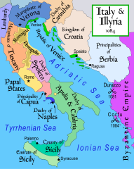
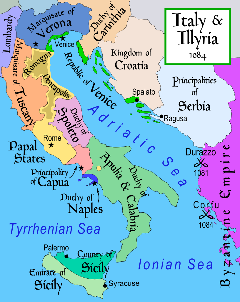
English: Map of Italy and the Illyrian coast in the year 1084.
Part of a series of maps on the history of Italy:
|
| Date | |
| Source | Own work |
| Author | MapMaster |
| Other versions |
[]
|
| SVG development |


References
- This map from Allyn & Bacon, Longman, textbook publishers.
- Bjorklund, Oddvar; Holmboe, Haakon; Rohr, Anders (1970) Historical Atlas of the World, Barnes & Noble, NY, SBN: 389-00253-4.
- Hammond Atlas Corporation (2007) Hammond Historical World Atlas.
- Matthew, Donald (1989) Atlas of Medieval Europe, Time-Life Books.
- This map of 1000 AD Italy from Fordham University, adapted from Muir's Historical Atlas, (1911).
- This map of 1050 AD Italy, from the 1923 The Historical Atlas by William R. Shepherd
- This Wikipedia map of the w:en:Holy Roman Empire
- Šišić, Ferdo (1990) Povijest Hrvata u vrijeme narodnih vladara & the Baška tablet (to denote the territorial integrity of Croatia; islands, coastal borders etc.)
Licensing
I, the copyright holder of this work, hereby publish it under the following license:
This file is licensed under the Creative Commons Attribution-Share Alike 2.5 Generic license.
- You are free:
- to share – to copy, distribute and transmit the work
- to remix – to adapt the work
- Under the following conditions:
- attribution – You must give appropriate credit, provide a link to the license, and indicate if changes were made. You may do so in any reasonable manner, but not in any way that suggests the licensor endorses you or your use.
- share alike – If you remix, transform, or build upon the material, you must distribute your contributions under the same or compatible license as the original.
derivative works
Derivative works of this file: Italy and Illyria 1084 v2-ar.svg
File history
Click on a date/time to view the file as it appeared at that time.
| Date/Time | Thumbnail | Dimensions | User | Comment | |
|---|---|---|---|---|---|
| current | 19:19, 22 October 2017 | | 586 × 735 (522 KB) | Ras67 | frame removed |
| 12:16, 23 November 2011 |  | 588 × 735 (644 KB) | Kathovo | Reverted to version as of 12:20, 29 July 2007 not an svg | |
| 18:06, 23 January 2011 |  | 480 × 600 (224 KB) | Er-vet-en | whoops, sorry for this | |
| 18:04, 23 January 2011 |  | 480 × 600 (224 KB) | Er-vet-en | resize | |
| 17:50, 23 January 2011 |  | 744 × 1,052 (224 KB) | Er-vet-en | plit and some islands are are actually in Croatia's dominion from about 1076 (since the previous map relied on maps from earlier) This is proven by the acclaimed historian Ferdo Šišić, and the culturally significant Bashka tablet (which proved that ki | |
| 12:20, 29 July 2007 |  | 588 × 735 (644 KB) | Lokal Profil | Cleaned up code (specifically loads of empty groups) | |
| 05:43, 15 April 2007 |  | 588 × 735 (695 KB) | MapMaster | Minor changes | |
| 03:56, 13 February 2007 |  | 588 × 735 (694 KB) | MapMaster | Map of Italy and the Illyrian coast in the year 1084 |
File usage
The following pages on the English Wikipedia use this file (pages on other projects are not listed):
Global file usage
The following other wikis use this file:
- Usage on ar.wikipedia.org
- Usage on azb.wikipedia.org
- Usage on bg.wikipedia.org
- Usage on bn.wikipedia.org
- Usage on bs.wikipedia.org
- Usage on ca.wikipedia.org
- Usage on cs.wikipedia.org
- Usage on da.wikipedia.org
- Usage on de.wikipedia.org
- Usage on el.wikipedia.org
- Usage on et.wikipedia.org
- Usage on eu.wikipedia.org
- Usage on fa.wikipedia.org
- Usage on fi.wikipedia.org
- Usage on fr.wikipedia.org
- Usage on hr.wikipedia.org
- Usage on hy.wikipedia.org
- Usage on id.wikipedia.org
View more global usage of this file.