
File:Irma 2017-09-06 1435Z.jpg

Size of this preview: 600 × 600 pixels. Other resolutions: 240 × 240 pixels | 480 × 480 pixels | 768 × 768 pixels | 1,024 × 1,024 pixels | 2,048 × 2,048 pixels | 4,800 × 4,800 pixels.
Original file (4,800 × 4,800 pixels, file size: 4.77 MB, MIME type: image/jpeg)
| This is a file from the Wikimedia Commons. Information from its description page there is shown below. Commons is a freely licensed media file repository. You can help. |
Summary
| Description |
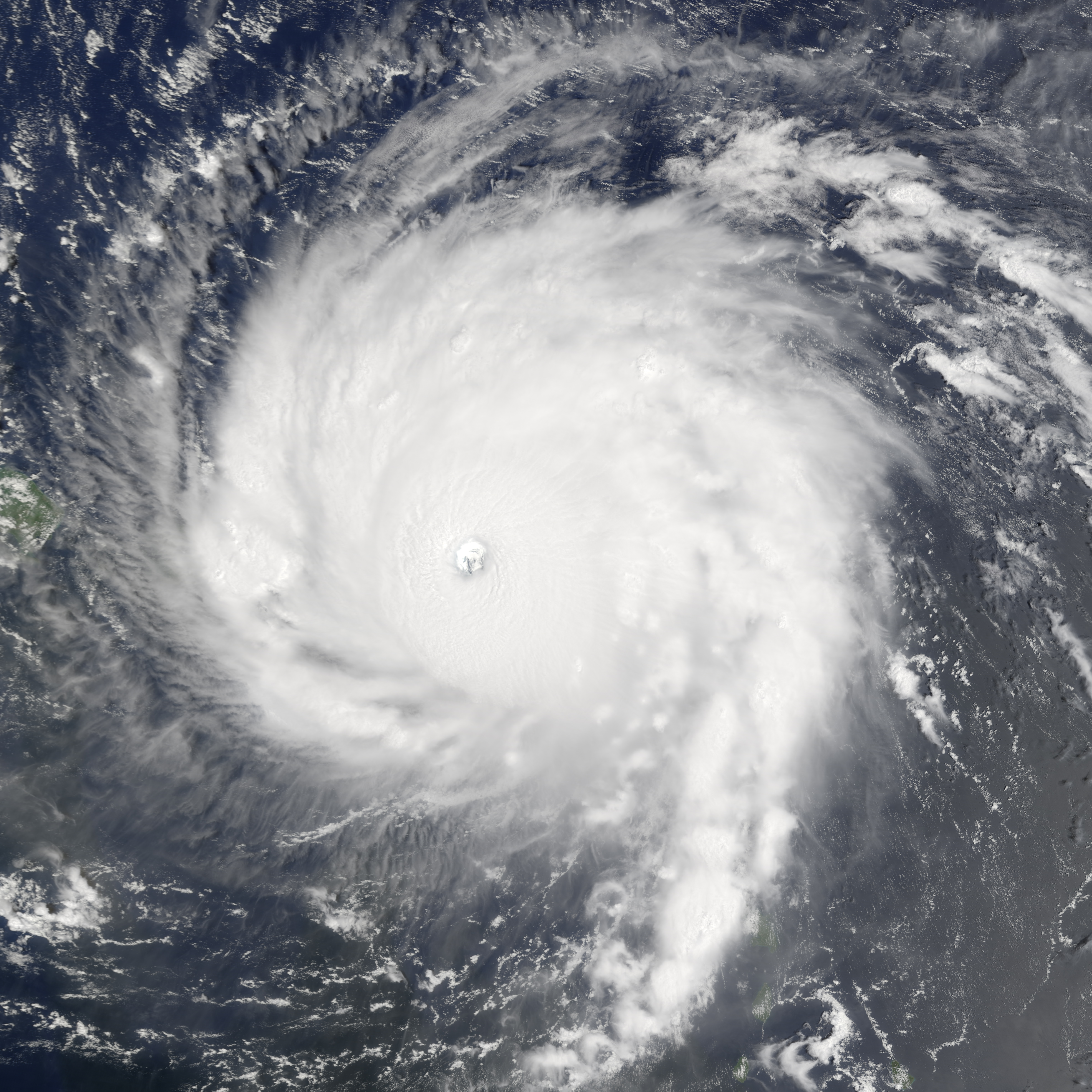
English: The Moderate Resolution Imaging Spectroradiometer (MODIS) on NASA’s Terra satellite acquired the third image at 10:35 a.m. local time (14:35 Universal Time) on September 6, 2017. By then, the storm had also hit Anguilla and was poised to strike the Virgin Islands. |
| Date | |
| Source | https://eoimages.gsfc.nasa.gov/images/imagerecords/90000/90912/irma_tmo_2017249_lrg.jpg |
| Author | NASA |
Licensing
| This file is in the public domain in the United States because it was solely created by NASA. NASA copyright policy states that "NASA material is not protected by copyright unless noted". (See Template:PD-USGov, NASA copyright policy page or JPL Image Use Policy.) | ||
 |
Warnings:
|
File history
Click on a date/time to view the file as it appeared at that time.
| Date/Time | Thumbnail | Dimensions | User | Comment | |
|---|---|---|---|---|---|
| current | 10:01, 27 October 2017 | | 4,800 × 4,800 (4.77 MB) | A1Cafel | User created page with UploadWizard |
File usage
The following pages on the English Wikipedia use this file (pages on other projects are not listed):