
File:Irma 2017-09-05 1706Z.jpg
Size of this preview: 450 × 600 pixels. Other resolutions: 180 × 240 pixels | 360 × 480 pixels | 576 × 768 pixels | 768 × 1,024 pixels | 1,536 × 2,048 pixels | 4,950 × 6,600 pixels.
Original file (4,950 × 6,600 pixels, file size: 8.39 MB, MIME type: image/jpeg)
| This is a file from the Wikimedia Commons. Information from its description page there is shown below. Commons is a freely licensed media file repository. You can help. |
Summary
| Description |
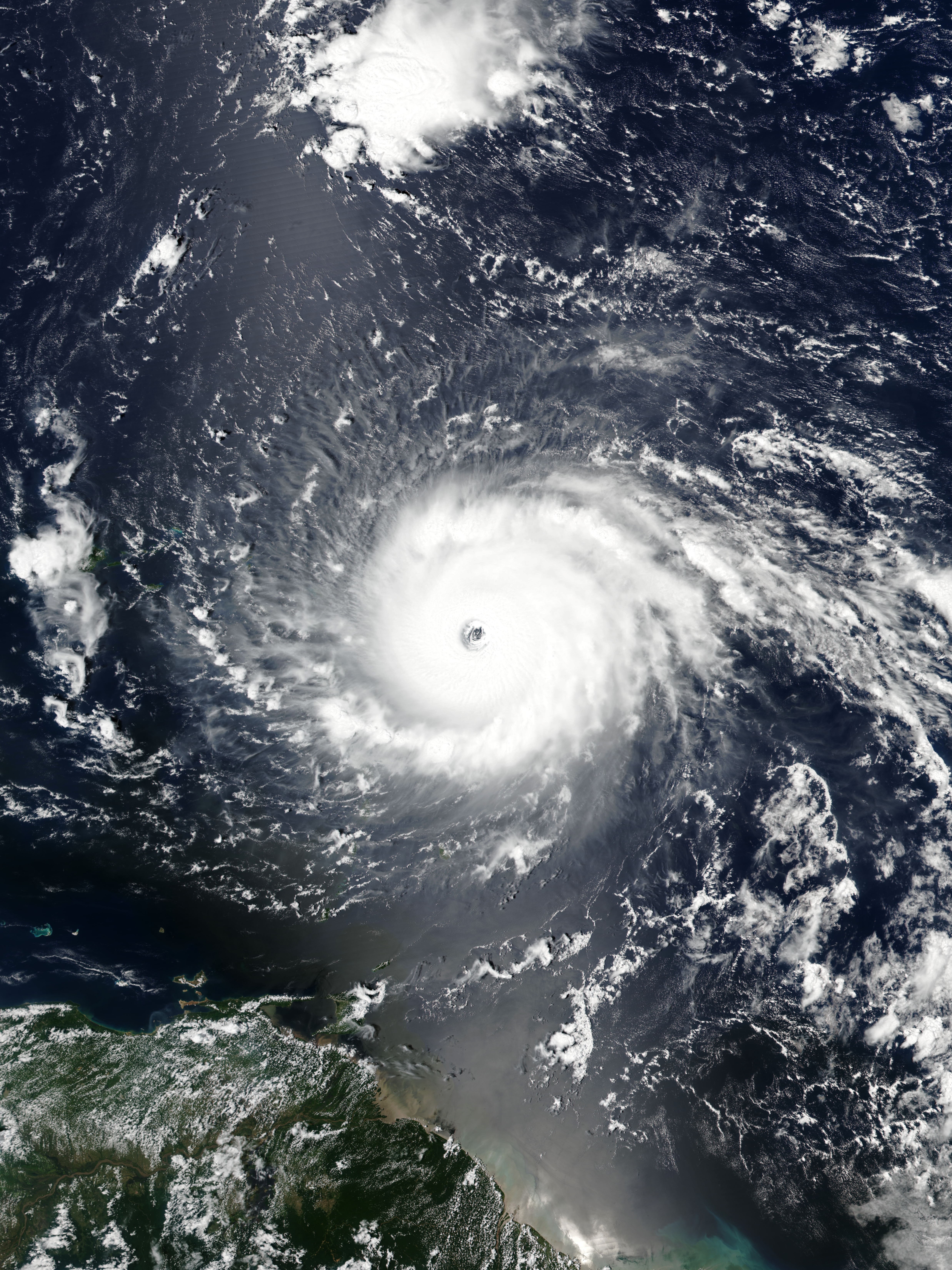
English: Hurricane Irma approaching the Leeward Islands at peak intensity on September 5, 2017 as the third most intense Atlantic hurricane on record in terms of sustained winds. |
| Date | |
| Source | EOSDIS Worldview |
| Author | VIIRS image captured by NOAA’s Suomi NPP satellite |
| Camera location | | View this and other nearby images on: OpenStreetMap |
|---|
Licensing
| This file is in the public domain in the United States because it was solely created by NASA. NASA copyright policy states that "NASA material is not protected by copyright unless noted". (See Template:PD-USGov, NASA copyright policy page or JPL Image Use Policy.) | ||
 |
Warnings:
|
File history
Click on a date/time to view the file as it appeared at that time.
| Date/Time | Thumbnail | Dimensions | User | Comment | |
|---|---|---|---|---|---|
| current | 01:21, 15 May 2021 | | 4,950 × 6,600 (8.39 MB) | Supportstorm | Reverted to version as of 21:19, 5 September 2017 (UTC) |
| 00:12, 15 May 2021 |  | 437 × 452 (89 KB) | Super Cyclonic Storm Corona | Crop a bit. | |
| 21:19, 5 September 2017 |  | 4,950 × 6,600 (8.39 MB) | Meow | User created page with UploadWizard |
File usage
The following pages on the English Wikipedia use this file (pages on other projects are not listed):
- Talk:2018 Atlantic hurricane season/Archive 2
- Talk:Hurricane Irma/Archive 2
- User:LightandDark2000/My Notable Storms
- User:Tfmbty/List of the most intense tropical cyclones since 1979
- User talk:36.82.216.113
- User talk:82.8.147.67
- Portal:Tropical cyclones/Anniversaries/September
- Portal:Tropical cyclones/Anniversaries/September/5
Global file usage
The following other wikis use this file:
- Usage on ca.wikipedia.org
- Usage on cs.wikipedia.org
- Usage on es.wikipedia.org
- Usage on et.wikipedia.org
- Usage on eu.wikipedia.org
- Usage on ga.wikipedia.org
- Usage on hu.wikipedia.org
- Usage on hy.wikipedia.org
- Usage on pt.wikipedia.org
- Usage on ru.wikipedia.org
- Usage on sd.wikipedia.org
- Usage on sr.wikipedia.org
- Usage on th.wikipedia.org
- Usage on uk.wikipedia.org
- Usage on uz.wikipedia.org
- Usage on www.wikidata.org
- Usage on zh.wikipedia.org