
File:Ingham County, MI census map.png
Size of this preview: 720 × 600 pixels. Other resolutions: 288 × 240 pixels | 576 × 480 pixels | 1,020 × 850 pixels.
Original file (1,020 × 850 pixels, file size: 189 KB, MIME type: image/png)
| This is a file from the Wikimedia Commons. Information from its description page there is shown below. Commons is a freely licensed media file repository. You can help. |
Summary
| Description |
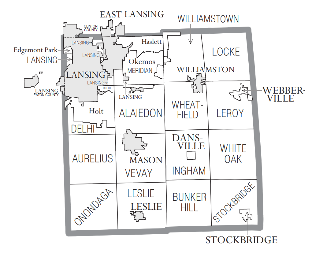
English: Ingham County, MI census data map |
| Date | 17:41, 26 November 2020 (UTC) |
| Source | Own work |
| Author | Notorious4life (talk) (Uploads) |
Licensing
I, the copyright holder of this work, hereby publish it under the following license:
| This file is made available under the Creative Commons CC0 1.0 Universal Public Domain Dedication. | |
| The person who associated a work with this deed has dedicated the work to the public domain by waiving all of their rights to the work worldwide under copyright law, including all related and neighboring rights, to the extent allowed by law. You can copy, modify, distribute and perform the work, even for commercial purposes, all without asking permission.
|
File history
Click on a date/time to view the file as it appeared at that time.
| Date/Time | Thumbnail | Dimensions | User | Comment | |
|---|---|---|---|---|---|
| current | 19:58, 23 December 2020 | | 1,020 × 850 (189 KB) | Notorious4life | updated Lansing's Clinton County boundary map |
| 21:26, 22 December 2020 |  | 1,020 × 850 (188 KB) | Notorious4life | updated Lansing boundaries to include Clinton County | |
| 17:41, 26 November 2020 |  | 1,020 × 850 (188 KB) | Notorious4life | == Summary == {{Information | description = Ingham County, MI census data map | source = {{own}} | date = ~~~~~ | author = Notorious4life (talk) (Uploads) | permission = | other_versions = | additional_information = }} == Licensing == {{self|cc-zero}} |
File usage
The following pages on the English Wikipedia use this file (pages on other projects are not listed):