
File:Indonesia Western New Guinea location map.png

Original file (1,035 × 1,031 pixels, file size: 129 KB, MIME type: image/png)
| This is a file from the Wikimedia Commons. Information from its description page there is shown below. Commons is a freely licensed media file repository. You can help. |
Summary
| Description |
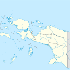
Quadratische Plattkarte. Geographische Begrenzung der Karte:
Equirectangular projection. Geographic limits of the map:
|
|
| Date | ||
| Source |
Own work, using
|
|
| Author | NordNordWest | |
| Permission (Reusing this file) |
This file is licensed under the Creative Commons Attribution-Share Alike 3.0 Germany license.
 This file is licensed under the Creative Commons Attribution-Share Alike 3.0 Germany license.
|


|
This map has been made or improved in the German Kartenwerkstatt (Map Lab). You can propose maps to improve as well.
|
Licensing
- You are free:
- to share – to copy, distribute and transmit the work
- to remix – to adapt the work
- Under the following conditions:
- attribution – You must give appropriate credit, provide a link to the license, and indicate if changes were made. You may do so in any reasonable manner, but not in any way that suggests the licensor endorses you or your use.
- share alike – If you remix, transform, or build upon the material, you must distribute your contributions under the same or compatible license as the original.
File history
Click on a date/time to view the file as it appeared at that time.
| Date/Time | Thumbnail | Dimensions | User | Comment | |
|---|---|---|---|---|---|
| current | 12:48, 4 August 2022 | | 1,035 × 1,031 (129 KB) | Afrogindahood | Addition of new provinces in Western New Guinea |
| 14:17, 19 December 2019 |  | 1,035 × 1,032 (134 KB) | Exogalaxy | =={{int:filedesc}}== {{Information |Description= {{de|Positionskarte der Molukken und von West-Neuguinea, Indonesien}} Quadratische Plattkarte. Geographische Begrenzung der Karte: * N: 3.0° N * S: 9.5° S * W: 129.0° O * O: 141.5° O {{en|Location map of Maluku and Western New Guinea, Indonesia}} Equirectangular projection. Geographic limits of the map: * N: 3.0° N * S: 9.5° S... |
File usage
More than 100 pages use this file. The following list shows the first 100 pages that use this file only. A full list is available.
- 1976 Papua earthquake
- Abun language
- Asia Islands
- Asmat Regency
- Ayamaru Lakes
- Baliem River
- Bawe
- Biak Numfor Regency
- Biak language
- Bintang Mountains Regency
- Bomberai Peninsula
- Boven Digoel Regency
- Cenderawasih Bay
- Central Mamberamo Regency
- Dampier Strait (Indonesia)
- Dead Birds (1963 film)
- Deiyai Regency
- Dogiyai Regency
- Domine Eduard Osok Airport
- Dortheys Hiyo Eluay International Airport
- Dusner language
- Fakfak Torea Airport
- Frans Kaisiepo International Airport
- Hatam language
- Ilaga, Central Papua
- Inanwatan
- Intan Jaya Regency
- Irarutu language
- Jayapura
- Jayapura Regency
- Jayawijaya Mountains
- Jayawijaya Regency
- Jefman Airport
- Kaimana
- Kalabra language
- Kalamang language
- Kamundan River
- Keerom Regency
- Kemberano language
- Komoran Island
- Konda language (Papuan)
- Kurima, Yahukimo
- Lanny Jaya Regency
- List of national parks of Indonesia
- Lobo, Indonesia
- Mamberamo Raya Regency
- Manokwari
- Mappi Regency
- Massep language
- Maybrat language
- Merauke
- Merauke Regency
- Meyah language
- Mimika Regency
- Moskona language
- Mozes Kilangin Airport
- Mpur language
- Muturi River
- Nabire Regency
- Nduga Regency
- Oktem
- Paniai Lakes
- Paniai Regency
- Pulau Ayu
- Pulau Reni
- Puncak Jaya
- Puncak Jaya Regency
- Puncak Mandala
- Puncak Regency
- Puncak Trikora
- Sailolof
- Salawati
- Saponi language
- Sarmi Regency
- Sausapor
- Sebakor Bay
- Seremuk River
- Sorong
- Sougb language
- Suabo language
- Supiori Regency
- Tanahmerah
- Tehit language
- Teluk Cenderawasih National Park
- Tembagapura
- Timika
- Tolikara Regency
- Tsinga
- Umari, Central Papua
- Uta, Central Papua
- Wamena
- Wamena Airport
- Waropen Regency
- Yahukimo Regency
- Yalimo Regency
- Yapen
- Yapen Islands Regency
- Yaur language
- Yeresiam language
- Yeretuar language
View more links to this file.
Global file usage
The following other wikis use this file:
- Usage on ban.wikipedia.org
- Usage on bcl.wikipedia.org
- Usage on ceb.wikipedia.org
- Usage on es.wikipedia.org
- Usage on fa.wikipedia.org
- Usage on fr.wikipedia.org
- Usage on id.wikipedia.org
- Timika (kota)
- Daftar taman nasional di Indonesia
- Sungai Mamberamo
- Bandar Udara Babo
- Bandar Udara Frans Kaisiepo-Biak
- Wamena, Jayawijaya
- Bandar Udara Sentani-Jayapura
- Pulau Fanildo
- Pulau Bras
- Semenanjung Bomberai
- Bandar Udara Oksibil
- Puncak Trikora
- Semenanjung Onin
- Kamu, Dogiyai
- Bahasa Sentani
- Bahasa Airoran
- Sungai Undir
- Bahasa Ambai
- Bahasa Awera
- Bahasa Arandai
- Bahasa Awban
- Pulau Waigeo
- Pulau Salawati
- Pulau Batanta
- Kota Waisai, Raja Ampat
- Sungai Fly
- Bandar Udara Fakfak
- Bandar Udara Arso
- Bandar Udara Bokondini
- Bandar Udara Ewer
- Pulau Misool
- Teluk Sebakor
- Sungai Kumbe
- Sungai Bian
- Sungai Maro
- Sungai Pulau
View more global usage of this file.