
File:Incursions vikings en Bretagne-fr.svg

Size of this PNG preview of this SVG file: 728 × 600 pixels. Other resolutions: 291 × 240 pixels | 583 × 480 pixels | 932 × 768 pixels | 1,243 × 1,024 pixels | 2,486 × 2,048 pixels | 1,112 × 916 pixels.
Original file (SVG file, nominally 1,112 × 916 pixels, file size: 238 KB)
| This is a file from the Wikimedia Commons. Information from its description page there is shown below. Commons is a freely licensed media file repository. You can help. |
Summary
| Description |
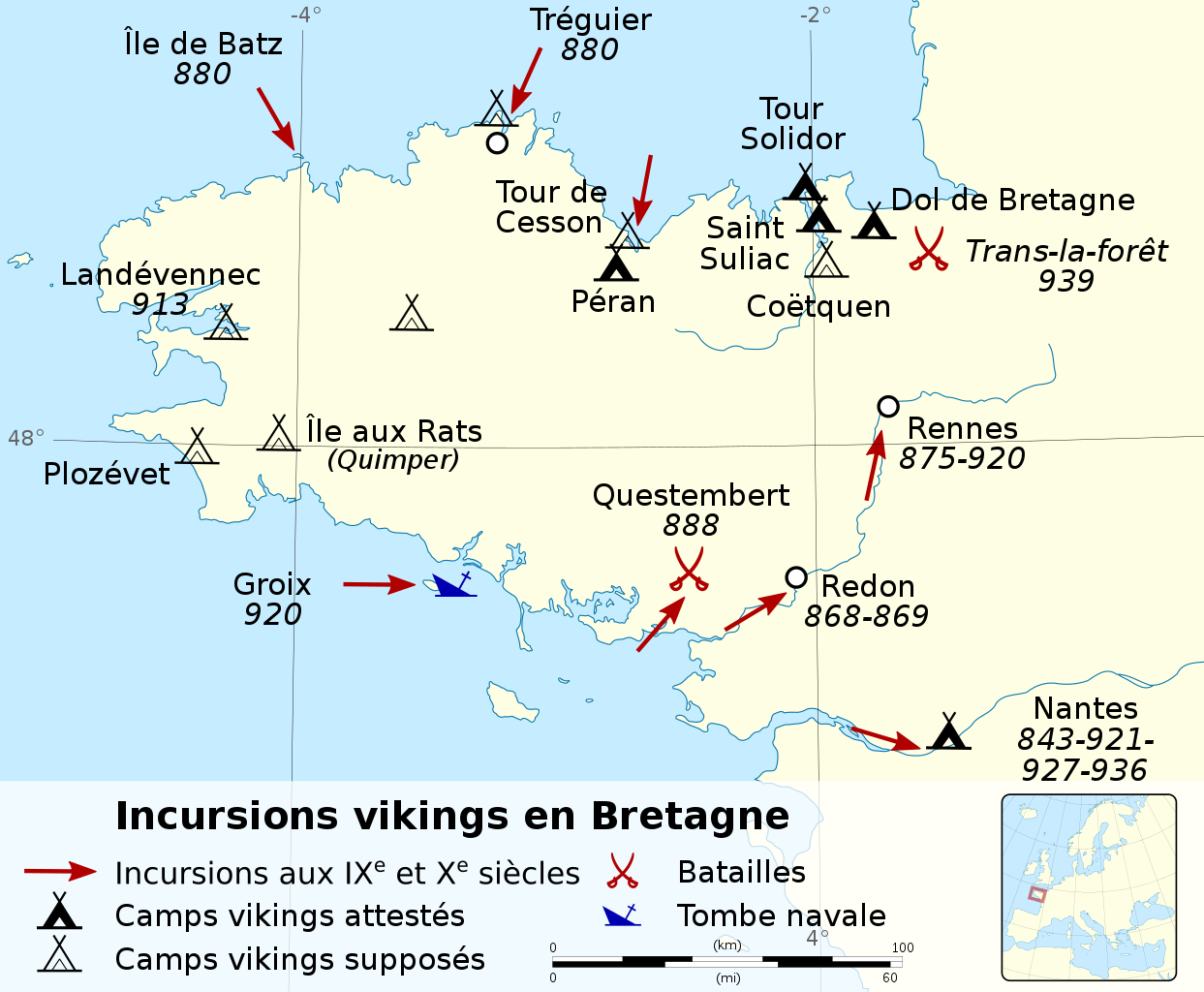
English: Map of Viking raids in Brittany between 843 and 939. Français : Carte des incursions vikings en Bretagne de 843 à 939. |
||
| Date | |||
| Source |
|
||
| Author | Sémhur (talk) | ||
| Permission (Reusing this file) |
|||
| Attribution (required by the license) | © Sémhur / Wikimedia Commons / | ||
| SVG development |
|

| Object location | | View this and other nearby images on: OpenStreetMap |
|---|
Licensing
I, the copyright holder of this work, hereby publish it under the following licenses:
| Copyleft: This work of art is free; you can redistribute it and/or modify it according to terms of the Free Art License. You will find a specimen of this license on the Copyleft Attitude site as well as on other sites. |
This file is licensed under the Creative Commons Attribution-Share Alike 4.0 International, 3.0 Unported, 2.5 Generic, 2.0 Generic and 1.0 Generic license.
- You are free:
- to share – to copy, distribute and transmit the work
- to remix – to adapt the work
- Under the following conditions:
- attribution – You must give appropriate credit, provide a link to the license, and indicate if changes were made. You may do so in any reasonable manner, but not in any way that suggests the licensor endorses you or your use.
- share alike – If you remix, transform, or build upon the material, you must distribute your contributions under the same or compatible license as the original.
You may select the license of your choice.
File history
Click on a date/time to view the file as it appeared at that time.
| Date/Time | Thumbnail | Dimensions | User | Comment | |
|---|---|---|---|---|---|
| current | 19:38, 22 May 2020 | | 1,112 × 916 (238 KB) | Sémhur | Inversion entre Saint-Suliac et Dol de Bretagne |
| 18:54, 27 August 2017 |  | 1,112 × 916 (238 KB) | Skimel | Rajout raid Viking de 843 (cité dans Histoire de la Bretagne de J. Cornette) | |
| 17:42, 15 August 2014 |  | 1,112 × 916 (229 KB) | Sémhur | == {{int:filedesc}} == {{Information |Description={{Multilingual description |en= Map of Viking raids in Brittany between 868 and 939. |fr= Carte des [[:fr:Histoire_de_la_Bretagne#Consolidation_et... |
File usage
The following pages on the English Wikipedia use this file (pages on other projects are not listed):
Global file usage
The following other wikis use this file:
- Usage on ca.wikipedia.org
- Usage on de.wikipedia.org
- Usage on el.wikipedia.org
- Usage on es.wikipedia.org
- Usage on fr.wikipedia.org
- Usage on fy.wikipedia.org
- Usage on ru.wikipedia.org
- Usage on uk.wikipedia.org