
File:ImprovedTownlandsWithLegendInThurlesCivilParish.jpg

Size of this preview: 800 × 565 pixels. Other resolutions: 320 × 226 pixels | 640 × 452 pixels | 1,024 × 723 pixels | 1,280 × 904 pixels | 2,040 × 1,441 pixels.
Original file (2,040 × 1,441 pixels, file size: 1,011 KB, MIME type: image/jpeg)
| This is a file from the Wikimedia Commons. Information from its description page there is shown below. Commons is a freely licensed media file repository. You can help. |
Summary
| Description |
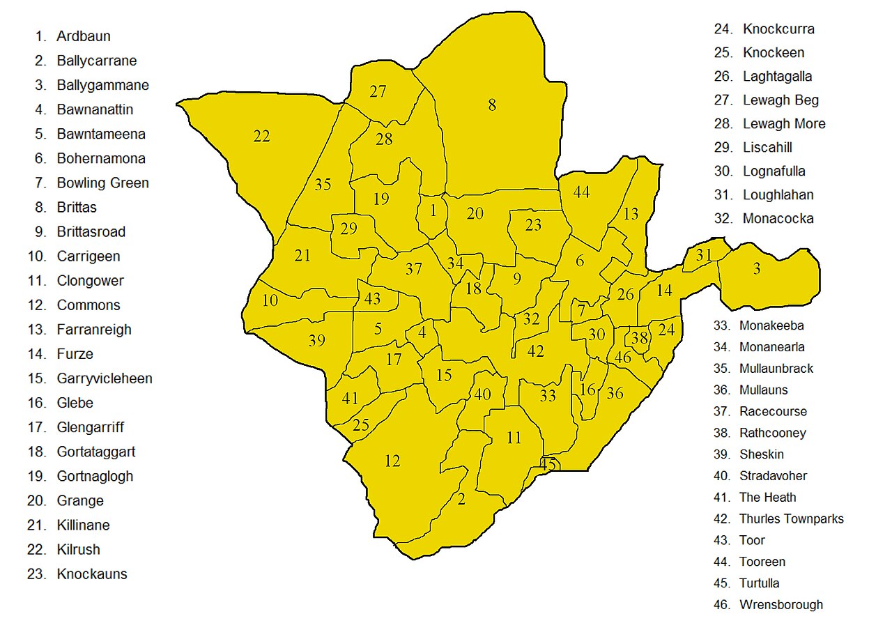
English: Improved map showing townlands in Thurles civil parish in North Tipperary, the improvement being to deal correctly with the boundary of that part of Farranreigh that protrudes into Bohernamona. A version of this map without the names is available here. Both maps are derived from derived from information in this Ordnance Survey map, corrected with information taken from this newer Ordnance Survey map in order to decide how to handle the boundary of that part of Farranreigh that protrudes into Bohernamona. |
| Date | |
| Source | Own work |
| Author | MartinCollin |
Licensing
I, the copyright holder of this work, hereby publish it under the following license:
This file is licensed under the Creative Commons Attribution-Share Alike 3.0 Unported license.
- You are free:
- to share – to copy, distribute and transmit the work
- to remix – to adapt the work
- Under the following conditions:
- attribution – You must give appropriate credit, provide a link to the license, and indicate if changes were made. You may do so in any reasonable manner, but not in any way that suggests the licensor endorses you or your use.
- share alike – If you remix, transform, or build upon the material, you must distribute your contributions under the same or compatible license as the original.
File history
Click on a date/time to view the file as it appeared at that time.
| Date/Time | Thumbnail | Dimensions | User | Comment | |
|---|---|---|---|---|---|
| current | 21:22, 25 September 2012 | | 2,040 × 1,441 (1,011 KB) | MartinCollin | User created page with UploadWizard |
File usage
The following pages on the English Wikipedia use this file (pages on other projects are not listed):
Global file usage
The following other wikis use this file: