
File:Idaho Transportation Department districts.png
Size of this preview: 389 × 600 pixels. Other resolutions: 155 × 240 pixels | 311 × 480 pixels | 498 × 768 pixels | 664 × 1,024 pixels | 2,000 × 3,084 pixels.
Original file (2,000 × 3,084 pixels, file size: 371 KB, MIME type: image/png)
| This is a file from the Wikimedia Commons. Information from its description page there is shown below. Commons is a freely licensed media file repository. You can help. |
Summary
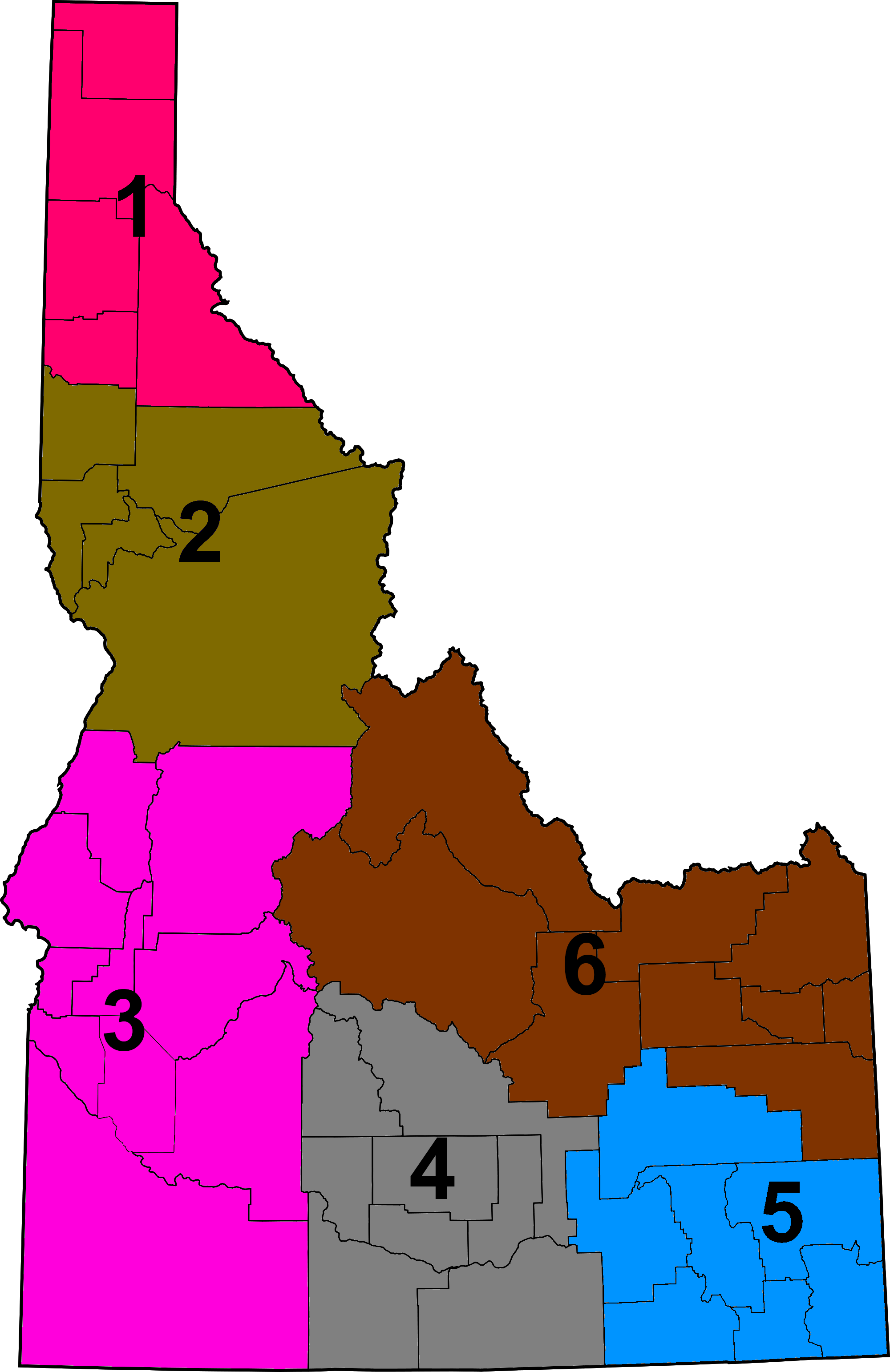
| Description | Map of Idaho Transportation Department districts |
| Date | (UTC) |
| Source | |
| Author |
| This is a retouched picture, which means that it has been digitally altered from its original version. Modifications: Changed colors, added numbers. The original can be viewed here: Map of Idaho highlighting Ada County.svg:
|
Licensing
I, the copyright holder of this work, hereby publish it under the following license:
| I, the copyright holder of this work, release this work into the public domain. This applies worldwide. In some countries this may not be legally possible; if so: I grant anyone the right to use this work for any purpose, without any conditions, unless such conditions are required by law. |
Original upload log
This image is a derivative work of the following images:
- File:Map_of_Idaho_highlighting_Ada_County.svg licensed with PD-self
- 2006-02-12T11:06:44Z David Benbennick 5061x7805 (111176 Bytes) {{subst:User:Dbenbenn/clm|county=Ada County|state=Idaho}}
Uploaded with derivativeFX
File history
Click on a date/time to view the file as it appeared at that time.
| Date/Time | Thumbnail | Dimensions | User | Comment | |
|---|---|---|---|---|---|
| current | 16:46, 29 October 2011 | | 2,000 × 3,084 (371 KB) | Presidentman | Lighter blue on district 5 |
| 16:44, 29 October 2011 |  | 2,000 × 3,084 (383 KB) | Presidentman | == {{int:filedesc}} == {{Information |Description=Map of Idaho Transportation Department districts |Source=*File:Map_of_Idaho_highlighting_Ada_County.svg |Date=2011-10-29 16:42 (UTC) |Author=*[[:File:Map_of_Idah |
File usage
The following pages on the English Wikipedia use this file (pages on other projects are not listed):