
File:Hornelen Basin geology.png

Size of this preview: 800 × 466 pixels. Other resolutions: 320 × 186 pixels | 640 × 372 pixels | 1,024 × 596 pixels | 1,280 × 745 pixels | 2,758 × 1,605 pixels.
Original file (2,758 × 1,605 pixels, file size: 3.42 MB, MIME type: image/png)
| This is a file from the Wikimedia Commons. Information from its description page there is shown below. Commons is a freely licensed media file repository. You can help. |
Summary
| Description |
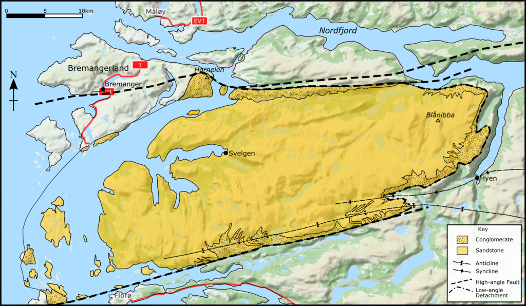
English: Geological map of the Hornelen Basin, modified after Fossen et al. 2016 and Norton et al. 1988, using a base map from OpenStreetMap (© OpenStreetMap contributors, CC BY-SA 2.0 - see here for reuse details), tiles by Andy Allan. |
| Date | |
| Source | Own work |
| Author | Mikenorton |
Licensing
I, the copyright holder of this work, hereby publish it under the following license:
This file is licensed under the Creative Commons Attribution-Share Alike 4.0 International license.
- You are free:
- to share – to copy, distribute and transmit the work
- to remix – to adapt the work
- Under the following conditions:
- attribution – You must give appropriate credit, provide a link to the license, and indicate if changes were made. You may do so in any reasonable manner, but not in any way that suggests the licensor endorses you or your use.
- share alike – If you remix, transform, or build upon the material, you must distribute your contributions under the same or compatible license as the original.
File history
Click on a date/time to view the file as it appeared at that time.
| Date/Time | Thumbnail | Dimensions | User | Comment | |
|---|---|---|---|---|---|
| current | 22:52, 3 September 2020 | | 2,758 × 1,605 (3.42 MB) | Mikenorton | Uploaded own work with UploadWizard |
File usage
The following pages on the English Wikipedia use this file (pages on other projects are not listed):