
File:Hohe Wand.JPG

Size of this preview: 400 × 600 pixels. Other resolutions: 160 × 240 pixels | 320 × 480 pixels | 512 × 768 pixels | 683 × 1,024 pixels | 1,365 × 2,048 pixels | 2,835 × 4,252 pixels.
Original file (2,835 × 4,252 pixels, file size: 11.91 MB, MIME type: image/jpeg)
| This is a file from the Wikimedia Commons. Information from its description page there is shown below. Commons is a freely licensed media file repository. You can help. |
Summary
| Description |
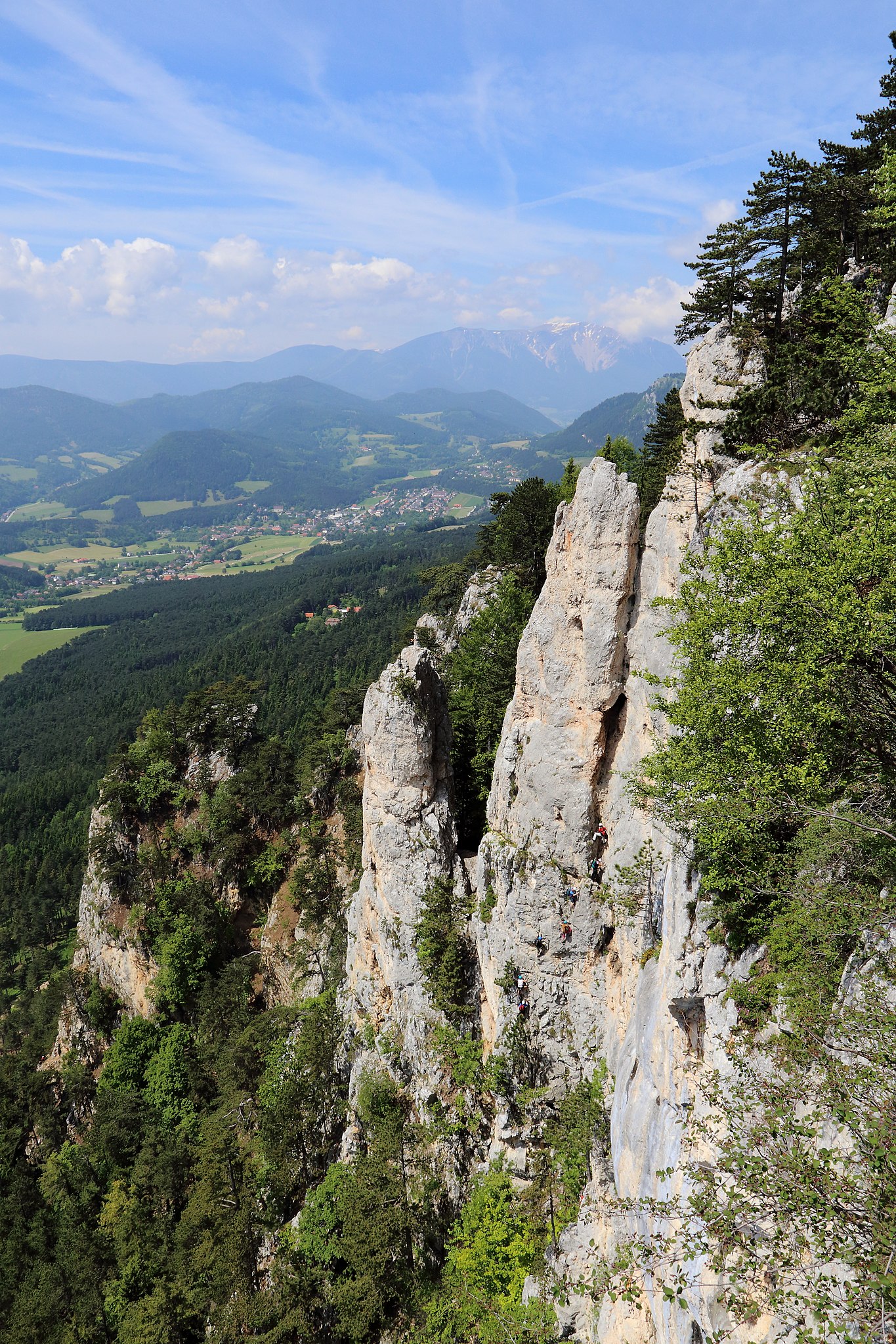
Deutsch: Die Hohe Wand Richtung Westen im Bereich zwischen dem Hubertushaus und der Großen Kanzel. Im Vordergrund links der Weningerturm, über den der 2013 eröffnete Gebirgsvereinssteig führt (einer der längster Klettersteige der Hohen Wand und erster im östlichen Niederösterreichs mit einer Seilbrücke). Etwas links der Bildmitte der Baumgartnerturm, rechts davon der Wildenauerturm, der durch den klassischen Wildenauersteig (1919 eröffnet) erschlossen ist und ganz rechts die Hochfallwand. Im Hintergrund Grünbach am Schneeberg und wiederum dahinter der noch leicht schneebedeckte Schneeberg, Niederösterreichs höchster Berg. |
| Date | |
| Source | Own work |
| Author | C.Stadler/Bwag |
| Permission (Reusing this file) |
Deutsch: Hallo, du darfst mein Foto kostenlos nutzen, aber nenne mich bitte als Fotograf, beispielsweise „Foto: C.Stadler/Bwag“ oder © C.Stadler/Bwag; CC-BY-SA-4.0. Auf mehr Angaben bestehe ich nicht - im Gegensatz zu manch anderen, die die Vorgaben der unten angeführten Lizenzierung auf Punkt und Beistrich einfordern. English: Feel free to use my photos, but please mention me as the author like © C.Stadler/Bwag or © C.Stadler/Bwag; CC-BY-SA-4.0 (that's good enough) and if you want send me a message: bwag@gmx.net. |
| Camera location | | View this and other nearby images on: OpenStreetMap |
|---|
Licensing
I, the copyright holder of this work, hereby publish it under the following license:
This file is licensed under the Creative Commons Attribution 3.0 Austria license.
- You are free:
- to share – to copy, distribute and transmit the work
- to remix – to adapt the work
- Under the following conditions:
- attribution – You must give appropriate credit, provide a link to the license, and indicate if changes were made. You may do so in any reasonable manner, but not in any way that suggests the licensor endorses you or your use.

File history
Click on a date/time to view the file as it appeared at that time.
| Date/Time | Thumbnail | Dimensions | User | Comment | |
|---|---|---|---|---|---|
| current | 17:23, 11 June 2013 | | 2,835 × 4,252 (11.91 MB) | Bwag | {{Information |Description= {{de|1= Die Hohe Wand Richtung Westen im Bereich zwischen dem Hubertushaus und der Großen Kanzel. Im Vordergrund links der Weningerturm, über den der 2013 eröffnete Gebirgsvereinssteig füh... |
File usage
The following pages on the English Wikipedia use this file (pages on other projects are not listed):
Global file usage
The following other wikis use this file:
- Usage on de.wikipedia.org
- Usage on et.wikipedia.org