
File:Historic Track, Goshen, NY.jpg

Size of this preview: 800 × 352 pixels. Other resolutions: 320 × 141 pixels | 640 × 281 pixels | 1,185 × 521 pixels.
Original file (1,185 × 521 pixels, file size: 166 KB, MIME type: image/jpeg)
| This is a file from the Wikimedia Commons. Information from its description page there is shown below. Commons is a freely licensed media file repository. You can help. |
|
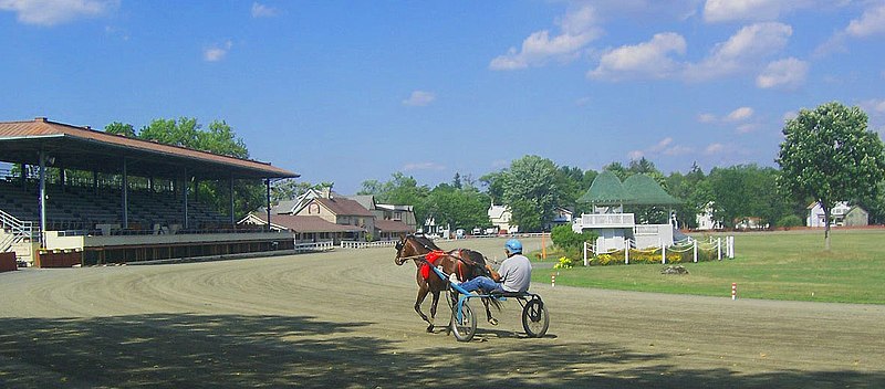
This is an image of a place or building that is listed on the National Register of Historic Places in the United States of America. Its reference number is 66000560. |
| Description | Photographed by Daniel Case on 2005-09-02. | ||||||||
| Date | 3 September 2005 (original upload date) | ||||||||
| Source | Transferred from en.wikipedia to Commons. | ||||||||
| Author | The original uploader was Daniel Case at English Wikipedia. | ||||||||
| Permission (Reusing this file) |
Daniel Case at the English-language Wikipedia, the copyright holder of this work, hereby publishes it under the following license:
|

| Object location | | View this and other nearby images on: OpenStreetMap |
|---|
Original upload log
The original description page was here. All following user names refer to en.wikipedia.
- 2005-09-03 04:07 Daniel Case 1185×521×8 (170195 bytes) Photographed by [[User:Daniel Case|Daniel Case]] on 2005-09-02. {{gfdl}}
File history
Click on a date/time to view the file as it appeared at that time.
| Date/Time | Thumbnail | Dimensions | User | Comment | |
|---|---|---|---|---|---|
| current | 21:19, 16 July 2007 | | 1,185 × 521 (166 KB) | Daniel Case | {{Information |Description=Photographed by Daniel Case on 2005-09-02. |Source=Originally from [http://en.wikipedia.org en.wikipedia]; description page is/was [http://en.wikipedia.org/w/index.php?title=Image%3AHambletonian.jpg here |
| 21:18, 16 July 2007 |  | 1,185 × 521 (166 KB) | Daniel Case | {{Information |Description=Photographed by Daniel Case on 2005-09-02. |Source=Originally from [http://en.wikipedia.org en.wikipedia]; description page is/was [http://en.wikipedia.org/w/index.php?title=Image%3AHambletonian.jpg here |
File usage
The following pages on the English Wikipedia use this file (pages on other projects are not listed):
Global file usage
The following other wikis use this file:
- Usage on de.wikipedia.org
- Usage on fr.wikipedia.org
- Usage on pt.wikipedia.org
- Usage on sv.wikipedia.org
- Usage on www.wikidata.org