
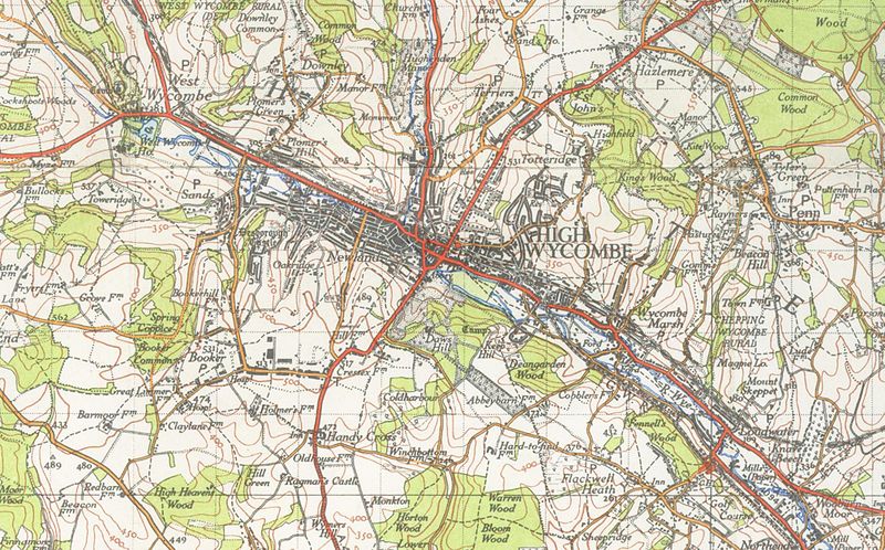
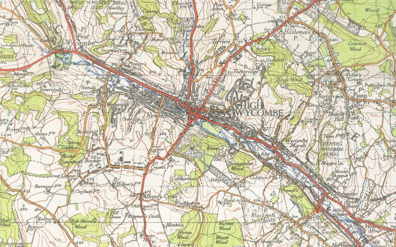
File:High Wycombe map1945.jpg

Size of this preview: 800 × 498 pixels. Other resolutions: 320 × 199 pixels | 640 × 399 pixels | 1,024 × 638 pixels | 1,280 × 798 pixels | 2,011 × 1,253 pixels.
Original file (2,011 × 1,253 pixels, file size: 1.94 MB, MIME type: image/jpeg)
| This is a file from the Wikimedia Commons. Information from its description page there is shown below. Commons is a freely licensed media file repository. You can help. |

|
This file was moved to Wikimedia Commons from en.wikipedia using a bot script. All source information is still present. It requires review. Additionally, there may be errors in any or all of the information fields; information on this file should not be considered reliable and the file should not be used until it has been reviewed and any needed corrections have been made. Once the review has been completed, this template should be removed. For details about this file, see below. Check now! |
| Description |
English: 1 inch to the mile OS map of High_Wycombe 1945 |
| Date | 20 January 2007 (original upload date) |
| Source | Transferred from en.wikipedia to Commons by Oxyman using CommonsHelper. |
| Author | The original uploader was Geni at English Wikipedia. |
Licensing
This work is an Ordnance Survey map over 50 years old, which is covered by Crown Copyright which in this case expires 50 years after publication. Ordnance Survey does however ask that they be credited and that the date of publication be given.
Any ancillary rights gained through the creation of the electronic version are granted as freely usable under any circumstances.
|
This work created by the United Kingdom Government is in the public domain.
This is because it is one of the following:
HMSO has declared that the expiry of Crown Copyrights applies worldwide (ref: HMSO Email Reply)
|
 |
Original upload log
The original description page was here. All following user names refer to en.wikipedia.
- 2007-01-20 14:59 Geni 2011×1253× (2037800 bytes) 1 inch to the mile OS map of High_Wycombe 1945 {{oldOS}}
File history
Click on a date/time to view the file as it appeared at that time.
| Date/Time | Thumbnail | Dimensions | User | Comment | |
|---|---|---|---|---|---|
| current | 23:37, 5 October 2009 | | 2,011 × 1,253 (1.94 MB) | File Upload Bot (Magnus Manske) | {{BotMoveToCommons|en.wikipedia|year={{subst:CURRENTYEAR}}|month={{subst:CURRENTMONTHNAME}}|day={{subst:CURRENTDAY}}}} {{Information |Description={{en|1 inch to the mile OS map of High_Wycombe 1945 en:Category:High Wycombe}} |Source=Transferred f |
File usage
The following pages on the English Wikipedia use this file (pages on other projects are not listed):
Global file usage
The following other wikis use this file:
- Usage on azb.wikipedia.org
- Usage on cs.wikipedia.org
- Usage on pt.wikipedia.org