
File:Hazelhurst-Florida-geology.png
Size of this preview: 591 × 600 pixels. Other resolutions: 236 × 240 pixels | 473 × 480 pixels | 756 × 768 pixels | 1,182 × 1,200 pixels.
Original file (1,182 × 1,200 pixels, file size: 525 KB, MIME type: image/png)
| This is a file from the Wikimedia Commons. Information from its description page there is shown below. Commons is a freely licensed media file repository. You can help. |
Summary
| Description |
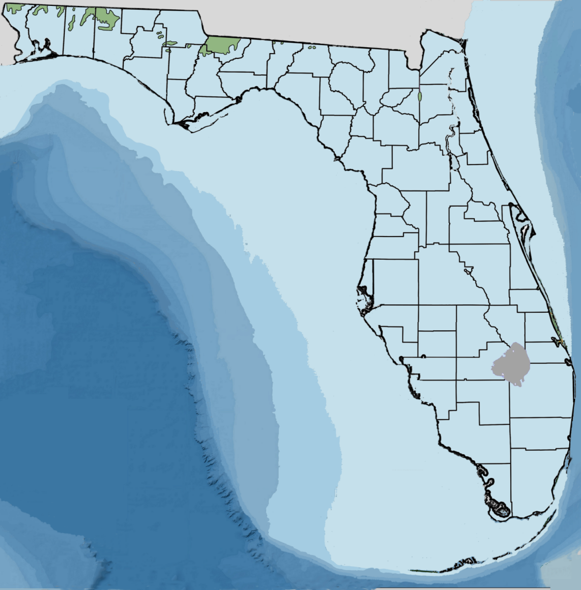
English: This map of prehistoric Florida depicts Florida's Hazelhurst terrace and shoreline dating from the Miocene or Pliocene epochs. Green indicates landmass between 97 to 65.5 meters (320—215 feet) mean sea level. The basis for this map are several maps from the FGS and State of Florida using an overlay. This map is copyrighted. |
| Date | |
| Source | Own work |
| Author | Noles1984 |
The author of this file is User:Noles1984. January 9, 2010.
Licensing
| I, the copyright holder of this work, release this work into the public domain. This applies worldwide. In some countries this may not be legally possible; if so: I grant anyone the right to use this work for any purpose, without any conditions, unless such conditions are required by law. |
File history
Click on a date/time to view the file as it appeared at that time.
| Date/Time | Thumbnail | Dimensions | User | Comment | |
|---|---|---|---|---|---|
| current | 20:22, 19 July 2010 | | 1,182 × 1,200 (525 KB) | Noles1984~commonswiki | {{Information |Description={{en|1=This map of prehistoric Florida depicts Florida's Hazelhurst terrace and shoreline dating from the Miocene or Pliocene epochs. Green indicates landmass between 97 to 65.5 meters (320—215 feet) mean sea level. The ba |
File usage
The following pages on the English Wikipedia use this file (pages on other projects are not listed):