
File:Hawaii national parks map.gif
No higher resolution available.
Hawaii_national_parks_map.gif (590 × 572 pixels, file size: 40 KB, MIME type: image/gif, 0.2 s)
| This is a file from the Wikimedia Commons. Information from its description page there is shown below. Commons is a freely licensed media file repository. You can help. |
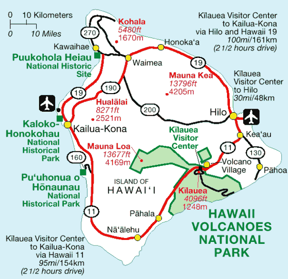
| Description | Map of National Park Service facilities on the Big island of Hawaiʻi. | |||
| Source | http://www.nps.gov/havo/images/map_island_large.gif | |||
| Author | ||||
| Permission (Reusing this file) |
|

|
This map image could be re-created using vector graphics as an SVG file. This has several advantages; see Commons:Media for cleanup for more information. If an SVG form of this image is available, please upload it and afterwards replace this template with
{{vector version available|new image name}}.
It is recommended to name the SVG file “Hawaii national parks map.svg”—then the template Vector version available (or Vva) does not need the new image name parameter. |
File history
Click on a date/time to view the file as it appeared at that time.
| Date/Time | Thumbnail | Dimensions | User | Comment | |
|---|---|---|---|---|---|
| current | 11:02, 12 April 2006 | | 590 × 572 (40 KB) | Szumyk | Map of National Park Service facilities on island of Hawaii. {{PD-USGov-Interior-NPS}} Source: http://www.nps.gov/havo/images/map_island_large.gif |
File usage
The following pages on the English Wikipedia use this file (pages on other projects are not listed):
Global file usage
The following other wikis use this file:
- Usage on da.wikipedia.org
- Usage on es.wikipedia.org
- Usage on fa.wikipedia.org
- Usage on fr.wikipedia.org
- Usage on it.wikipedia.org
- Usage on ja.wikipedia.org
- Usage on no.wikipedia.org
- Usage on ro.wikipedia.org
- Usage on tr.wikipedia.org
- Usage on www.wikidata.org
- Usage on zh.wikipedia.org