
File:Harvard stations simplified map.svg

Size of this PNG preview of this SVG file: 519 × 599 pixels. Other resolutions: 208 × 240 pixels | 416 × 480 pixels | 665 × 768 pixels | 887 × 1,024 pixels | 1,774 × 2,048 pixels | 921 × 1,063 pixels.
Original file (SVG file, nominally 921 × 1,063 pixels, file size: 47 KB)
| This is a file from the Wikimedia Commons. Information from its description page there is shown below. Commons is a freely licensed media file repository. You can help. |
Summary
| Description |
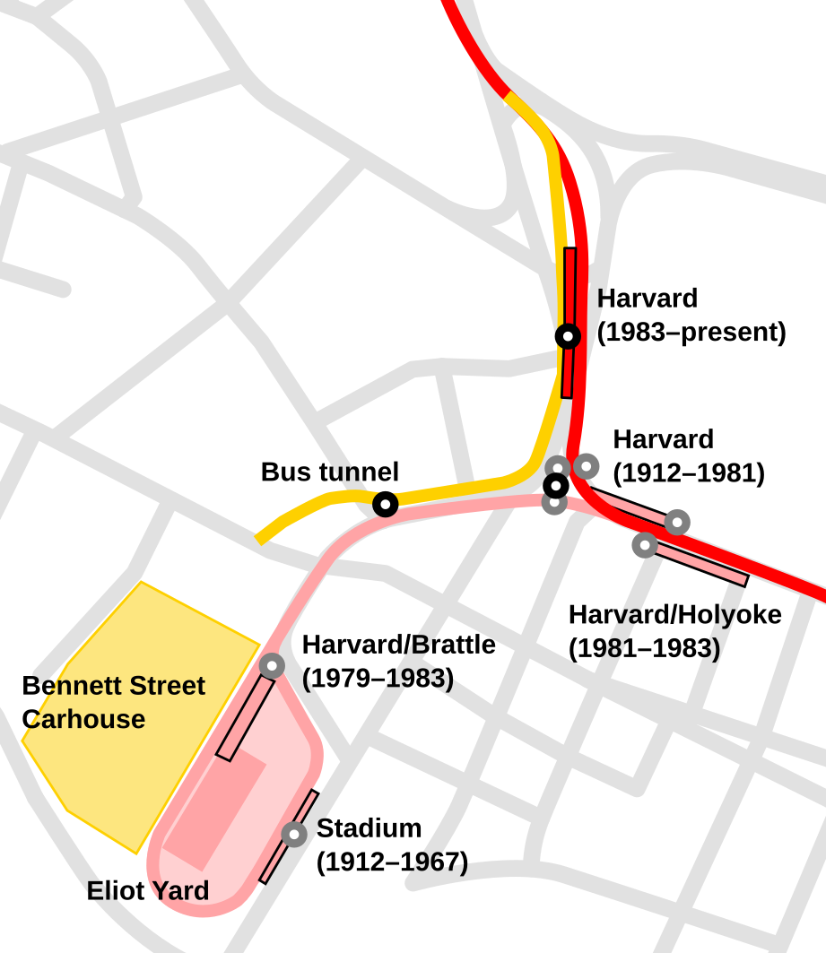
English: Map showing the approximate platform and headhouse locations of Harvard station and its four predecessors, plus the Eliot Yard and Bennett Street Carhouse. The current Red Line is shown in red, with black headhouse locations. The former alignment and stations are shown in pink, with gray headhouse locations.
Note: this map is intentionally simplified to serve as an illustration. The multiple levels of the Harvard stations and the bus tunnel are not shown, nor is the track layout. Streets are not shown at their exact widths. |
| Date | |
| Source | Own work |
| Author | User:Pi.1415926535 |
Licensing
I, the copyright holder of this work, hereby publish it under the following license:
This file is licensed under the Creative Commons Attribution-Share Alike 4.0 International license.
- You are free:
- to share – to copy, distribute and transmit the work
- to remix – to adapt the work
- Under the following conditions:
- attribution – You must give appropriate credit, provide a link to the license, and indicate if changes were made. You may do so in any reasonable manner, but not in any way that suggests the licensor endorses you or your use.
- share alike – If you remix, transform, or build upon the material, you must distribute your contributions under the same or compatible license as the original.
File history
Click on a date/time to view the file as it appeared at that time.
| Date/Time | Thumbnail | Dimensions | User | Comment | |
|---|---|---|---|---|---|
| current | 13:15, 16 June 2019 | | 921 × 1,063 (47 KB) | Pi.1415926535 | add other entrances to 1912-1981 station |
| 02:57, 14 April 2019 |  | 921 × 1,063 (46 KB) | Pi.1415926535 | {{Information |description ={{en|1=Map showing the approximate platform and headhouse locations of Harvard station and its four predecessors, plus the Eliot Yard and Bennett Street Carhouse. The current Red Line is shown in red, with black headhouse locations. The former alignment and stations are shown in pink, with gray headhouse locations. Note: this map is intentionally simplified to serve as an illustration. The multiple levels of the Harvard stations and the bus tunnel are not shown... |
File usage
The following pages on the English Wikipedia use this file (pages on other projects are not listed):