
File:Hampton Natl Historic Site.jpg
Size of this preview: 800 × 512 pixels. Other resolutions: 320 × 205 pixels | 640 × 409 pixels | 1,024 × 655 pixels | 1,280 × 819 pixels | 1,781 × 1,139 pixels.
Original file (1,781 × 1,139 pixels, file size: 849 KB, MIME type: image/jpeg)
| This is a file from the Wikimedia Commons. Information from its description page there is shown below. Commons is a freely licensed media file repository. You can help. |
|
This is an image of a place or building that is listed on the National Register of Historic Places in the United States of America. Its reference number is 66000389. |
Summary
| Camera location | | View this and other nearby images on: OpenStreetMap |
|---|
| Description |
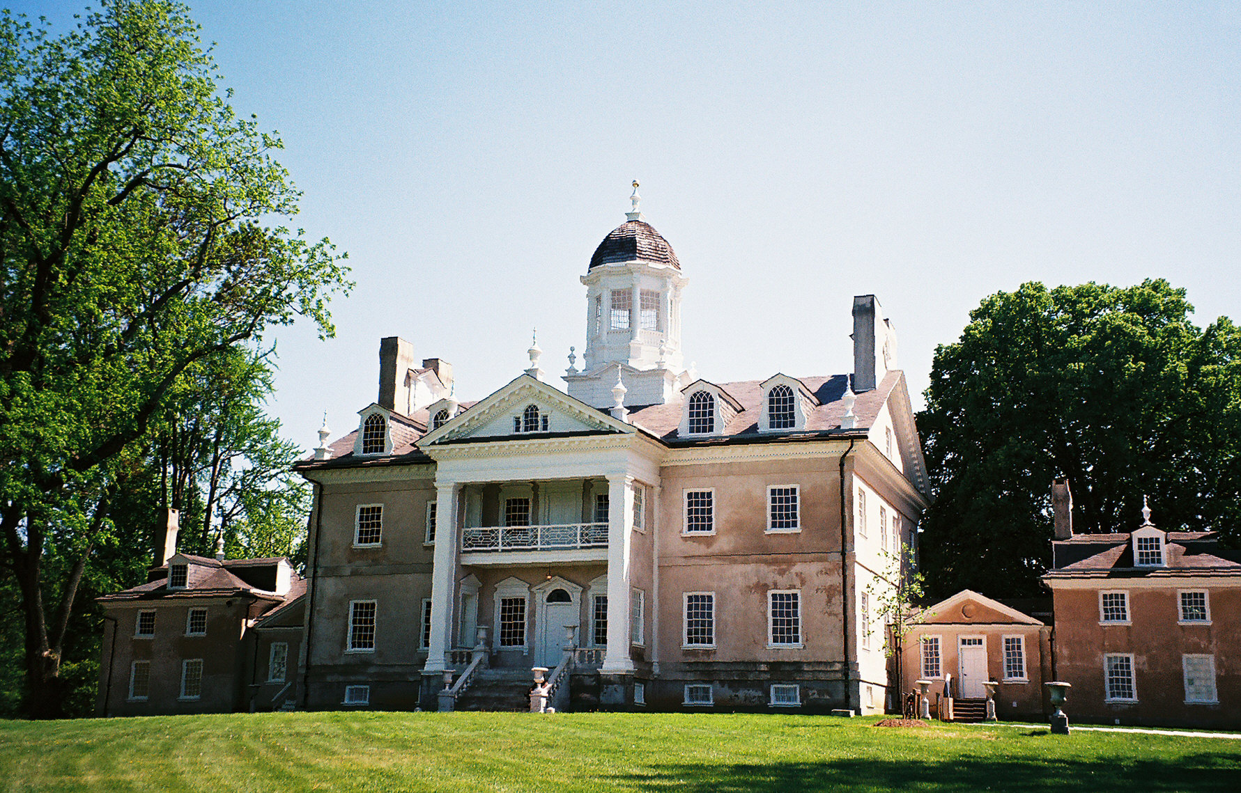
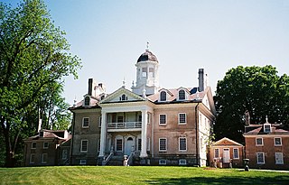
English: Front (north) elevation of the mansion at Hampton National Historic Site, in the Hampton area north of Towson, Maryland, U.S. |
| Date |
21 May 2008 (original upload date) |
| Source | Own work (Original text: User:JGHowes) |
| Author | JGHowes, photographer; taken with Canon AE-1 using Kodachrome film |
| Permission (Reusing this file) |
ATTRIBUTION. © by James G. Howes, 2008. Copyright holder must be properly attributed. |
| Other versions |
 |
Licensing

|
The copyright holder of this file, James G. Howes, allows anyone to use it for any purpose, provided that the copyright holder is properly attributed. Redistribution, derivative work, commercial use, and all other use is permitted. |
Attribution:
James G. Howes
|
(Original text: User:JGHowes)
|Date=21 May 2008 (original upload date)
(Original text: May, 2008)
|Author=en:User:JGHowes, photographer / Original uploader was JGHowes at English Wikipedia
|Permission=(Original text: © by James G. Howes, May, 2008.
Copyright holder must be properly attributed.)
Original upload log
Transferred from en.wikipedia to Commons by JGHowes.
The original description page was here. All following user names refer to en.wikipedia.
- 2008-05-21 22:31 JGHowes 1781×1139× (869225 bytes) {{Information |Description=Front (north) elevation of the mansion at '''[[Hampton National Historic Site]]''', in the [[Hampton, Maryland|Hampton]] area north of [[Towson, Maryland]], approximate lat/long: {{coor dms|39|24|58|N|76|35|15|W|}}. {{spaces|3}}
File history
Click on a date/time to view the file as it appeared at that time.
| Date/Time | Thumbnail | Dimensions | User | Comment | |
|---|---|---|---|---|---|
| current | 03:50, 28 March 2009 | | 1,781 × 1,139 (849 KB) | File Upload Bot (Magnus Manske) | {{BotMoveToCommons|en.wikipedia|year={{subst:CURRENTYEAR}}|month={{subst:CURRENTMONTHNAME}}|day={{subst:CURRENTDAY}}}} {{Information |Description={{en|Front (north) elevation of the mansion at '''en:Hampton National Historic Site''', in the [[:en:Ha |
File usage
The following pages on the English Wikipedia use this file (pages on other projects are not listed):
Global file usage
The following other wikis use this file:
- Usage on ceb.wikipedia.org
- Usage on en.wikivoyage.org
- Usage on es.wikipedia.org
- Usage on fr.wikipedia.org
- Usage on ja.wikipedia.org
- Usage on www.wikidata.org
- Usage on zh.wikipedia.org