
File:HUC1109.jpg

No higher resolution available.
HUC1109.jpg (632 × 434 pixels, file size: 498 KB, MIME type: image/jpeg)
| This is a file from the Wikimedia Commons. Information from its description page there is shown below. Commons is a freely licensed media file repository. You can help. |
Summary
| Description |
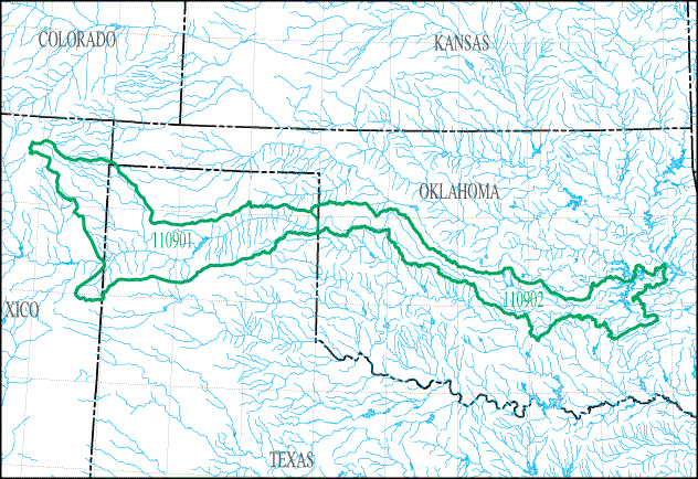
English: Map of HUC1109 - The Canadian River Basin below its intersect with the New Mexico-Texas state line to the confluence with the Arkansas River, including that portion inundated by Eufaula Lake and Robert S. Kerr Reservoir, but excluding the North Canadian River Basin. |
| Date | |
| Source | https://water.usgs.gov/wsc/sub/1109.jpg |
| Author | USGS |
Licensing
This image is in the public domain in the United States because it only contains materials that originally came from the United States Geological Survey, an agency of the United States Department of the Interior. For more information, see the official USGS copyright policy.
|
File history
Click on a date/time to view the file as it appeared at that time.
| Date/Time | Thumbnail | Dimensions | User | Comment | |
|---|---|---|---|---|---|
| current | 23:18, 11 September 2018 | | 632 × 434 (498 KB) | Furicorn | Transferred from https://water.usgs.gov/wsc/sub/1109.jpg |
File usage
The following pages on the English Wikipedia use this file (pages on other projects are not listed):