
File:Guide Rock, Nebraska Pike marker.JPG
Size of this preview: 800 × 571 pixels. Other resolutions: 320 × 228 pixels | 640 × 457 pixels | 1,024 × 731 pixels | 1,280 × 914 pixels | 2,488 × 1,776 pixels.
Original file (2,488 × 1,776 pixels, file size: 1.68 MB, MIME type: image/jpeg)
| This is a file from the Wikimedia Commons. Information from its description page there is shown below. Commons is a freely licensed media file repository. You can help. |
|
This is an image of a place or building that is listed on the National Register of Historic Places in the United States of America. Its reference number is 66000455. |
Summary
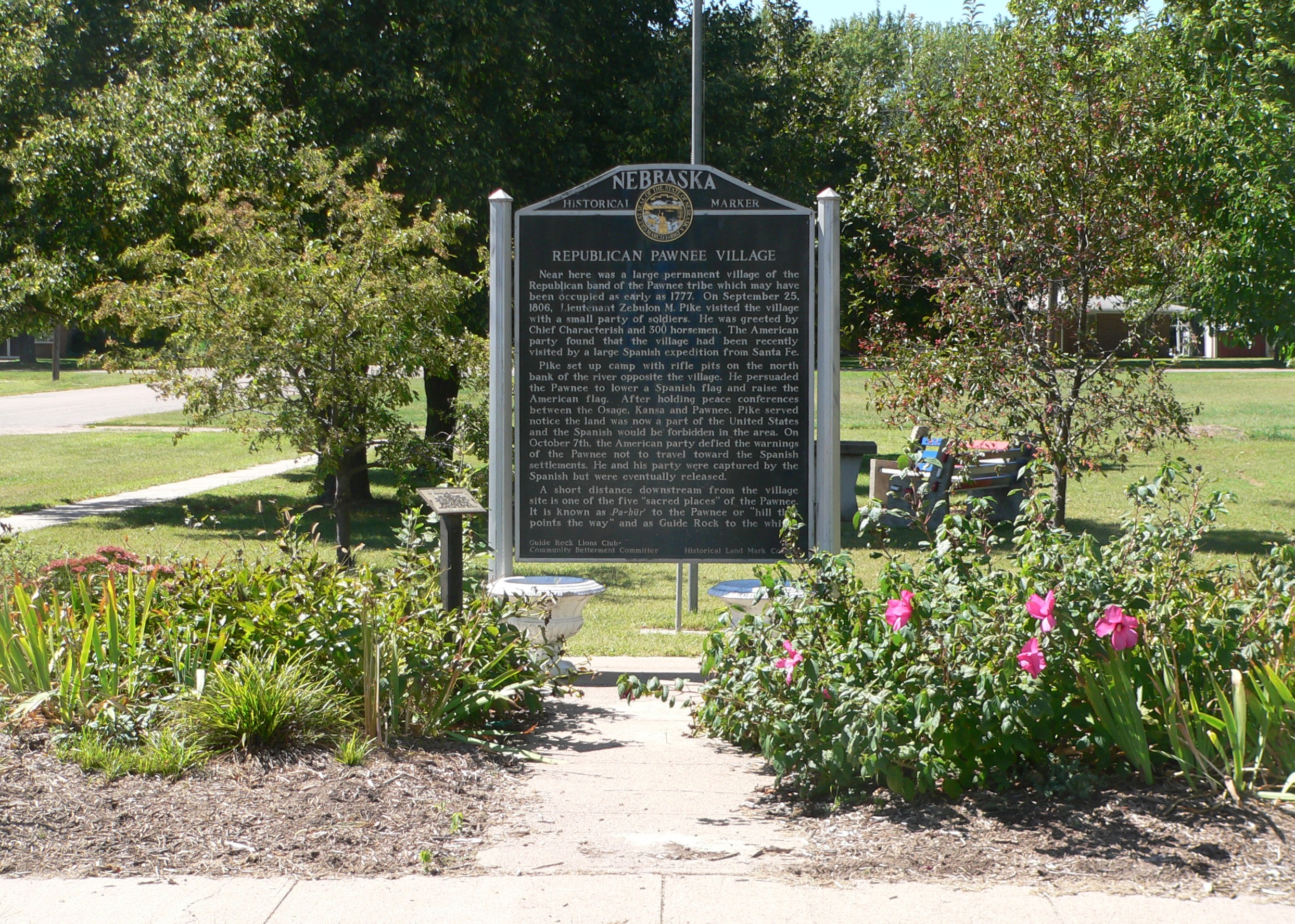
| Description | Nebraska state historical marker at northwest corner of State Street and University Street (Nebraska Highway 78 in northern Guide Rock, Nebraska. The marker commemorates the nearby Pike-Pawnee Village Site, a village of the Republican Pawnee visited by Zebulon Pike in 1806. |
| Date | |
| Source | Own work |
| Author | Ammodramus |
| Object location | | View this and other nearby images on: OpenStreetMap |
|---|
Licensing
| I, the copyright holder of this work, release this work into the public domain. This applies worldwide. In some countries this may not be legally possible; if so: I grant anyone the right to use this work for any purpose, without any conditions, unless such conditions are required by law. |
File history
Click on a date/time to view the file as it appeared at that time.
| Date/Time | Thumbnail | Dimensions | User | Comment | |
|---|---|---|---|---|---|
| current | 20:15, 6 September 2010 | | 2,488 × 1,776 (1.68 MB) | Ammodramus | {{Information |Description=Nebraska state historical marker at northwest corner of State Street and University Street ({{w|Nebraska Highway 78}} in northern {{w|Guide Rock, Nebraska}}. The marker commemorates the nearby {{w|Pike-Pawnee Village Site}}, a |
File usage
The following pages on the English Wikipedia use this file (pages on other projects are not listed):
Global file usage
The following other wikis use this file:
- Usage on de.wikipedia.org
- Usage on fr.wikipedia.org
- Usage on www.wikidata.org