
File:Great lakes basin.jpg

Size of this preview: 776 × 600 pixels. Other resolutions: 311 × 240 pixels | 621 × 480 pixels | 994 × 768 pixels | 1,280 × 989 pixels | 1,650 × 1,275 pixels.
Original file (1,650 × 1,275 pixels, file size: 675 KB, MIME type: image/jpeg)
| This is a file from the Wikimedia Commons. Information from its description page there is shown below. Commons is a freely licensed media file repository. You can help. |
Summary
| Description |
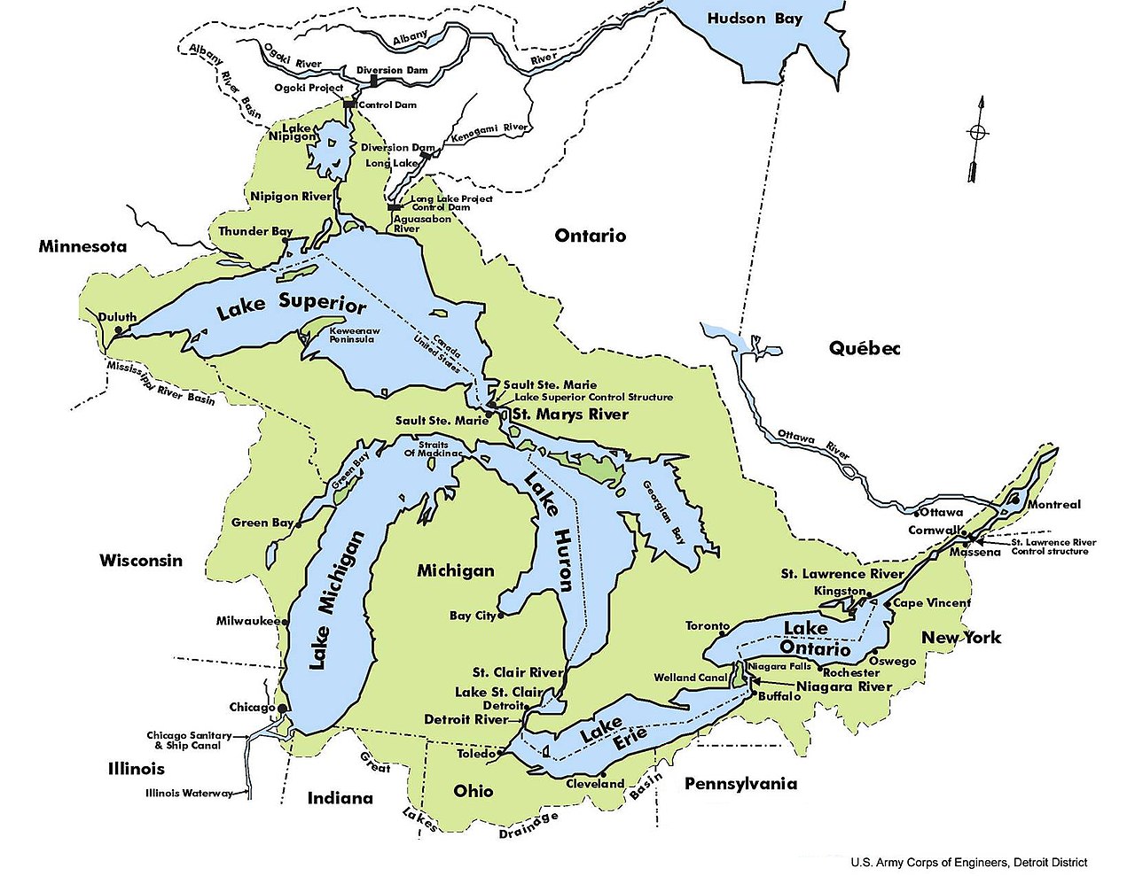
English: Map of the Great Lakes Basin, produced by the Detroit office of the US Army Corps of Engineers. It includes not only the Great Lakes, but the watersheds that drain the surrounding lands and waterways that feed those lakes. |
| Date | 3 September 2007 (according to Exif data) |
| Source | Own work by the original uploader |
| Author |
Licensing
This image or file is a work of a U.S. Army Corps of Engineers soldier or employee, taken or made as part of that person's official duties. As a work of the U.S. federal government, the image is in the public domain.
|
Original upload log
Transferred from en.wikipedia to Commons using For the Common Good.
The original description page was here. All following user names refer to en.wikipedia.
| Date/Time | Dimensions | User | Comment |
|---|---|---|---|
| 17:27, 3 September 2007 | 1,650 × 1,275 (691,649 bytes) | w:en:Pnoble805 (talk | contribs) | Map of the Great Lakes Basin, produced by the Detroit office of the US Army Corps of Engineers. It includes not only the Great Lakes, but the watersheds that drain the surrounding lands and waterways that feed those lakes. |
File history
Click on a date/time to view the file as it appeared at that time.
| Date/Time | Thumbnail | Dimensions | User | Comment | |
|---|---|---|---|---|---|
| current | 03:36, 8 January 2018 | | 1,650 × 1,275 (675 KB) | Illegitimate Barrister | Transferred from en.wikipedia: see original upload log above |
File usage
The following pages on the English Wikipedia use this file (pages on other projects are not listed):