File:Gorskii 04448u.jpg

Page contents not supported in other languages.
This is a file from the Wikimedia Commons
From Wikipedia, the free encyclopedia

Original file(3,235 × 2,845 pixels, file size: 4.4 MB, MIME type: image/jpeg)

Summary

Description
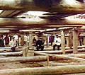
Русский: Плотина на Оке в районе Белоомута, Московская губерния. Рабочие и руководители позируют на фоне подготовки к заливке фундамента плотинного шлюза.
English: Laying concrete for the dam's sluice. [Beloomut]. Workers and supervisors posing for photograph amid preparations for pouring cement for sluice dam foundation across the Oka River near Beloomut.
Date
Source

Sergei Mikhailovich Prokudin-Gorskii Collection (Library of Congress)

This image is available from the United States Library of Congress's Prints and Photographs division
under the digital ID ppmsc.04448.
This tag does not indicate the copyright status of the attached work. A normal copyright tag is still required. See Commons:Licensing.

العربية  беларуская (тарашкевіца)  বাংলা  čeština  Deutsch  English  español  فارسی  suomi  français  galego  עברית  magyar  Bahasa Indonesia  italiano  日本語  lietuvių  македонски  മലയാളം  Nederlands  polski  português  português do Brasil  română  русский  sicilianu  slovenčina  slovenščina  Türkçe  українська  简体中文  繁體中文  +/−

Author
Sergei Prokudin-Gorskii  (1863–1944)  wikidata:Q101516
 
Sergei Prokudin-Gorskii
Alternative names
Description Russian-French photographer, chemist, inventor, publisher, pedagogue and teacher
Date of birth/death 18 August 1863 (in Julian calendarEdit this at Wikidata 27 September 1944 Edit this at Wikidata
Location of birth/death Murom, Russian Empire Paris
Authority file
creator QS:P170,Q101516
  • digital rendering for the Library of Congress by Walter Frankhauser / WalterStudio,
  • synchronization of canals by Юкатан
Permission
(Reusing this file)
There are no known restrictions on the use of this image.
Camera location54° 56′ 50.82″ N, 39° 15′ 31.39″ E Kartographer map based on OpenStreetMap.View this and other nearby images on: OpenStreetMapinfo
Object location54° 56′ 52.97″ N, 39° 15′ 11.54″ E Kartographer map based on OpenStreetMap.View this and other nearby images on: OpenStreetMapinfo

Licensing

Public domain

The author died in 1944, so this work is in the public domain in its country of origin and other countries and areas where the copyright term is the author's life plus 75 years or fewer.


This work is in the public domain in the United States because it was published (or registered with the U.S. Copyright Office) before January 1, 1929.

Captions

Add a one-line explanation of what this file represents

Items portrayed in this file

depicts

54°56'52.973"N, 39°15'11.542"E

image/jpeg

20e57fd8f60e8bc4b3b6db730d24d866e7d31a66

4,618,479 byte

2,845 pixel

3,235 pixel

54°56'50.820"N, 39°15'31.392"E

File history

Click on a date/time to view the file as it appeared at that time.

Date/TimeThumbnailDimensionsUserComment
current11:47, 17 December 2014Thumbnail for version as of 11:47, 17 December 20143,235 × 2,845 (4.4 MB)Юкатанsynchronized
23:14, 27 September 2007Thumbnail for version as of 23:14, 27 September 20073,235 × 2,845 (3.13 MB)Gorgo{{Information |Description=Original Description: ''Laying concrete for the dam's sluice. [Beloomut]. Workers and supervisors posing for photograph amid preparations for pouring cement for sluice dam foundation across the Oka River near Beloomut.'' |Source
The following pages on the English Wikipedia use this file (pages on other projects are not listed):

Global file usage

Metadata