
File:Glendora, California (7134837923).jpg

Original file (1,600 × 1,063 pixels, file size: 666 KB, MIME type: image/jpeg)
| This is a file from the Wikimedia Commons. Information from its description page there is shown below. Commons is a freely licensed media file repository. You can help. |
.jpg)
Summary
| Description |
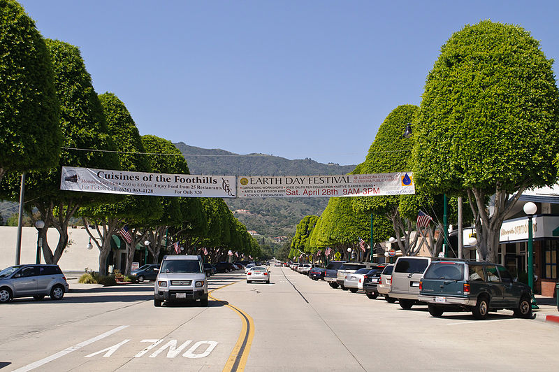
Looking north from Civic Center along Glendora Avenue, which is the historical shopping area that still is home to mom-and-pop stores. I am paying a visit to Glendora, located along the old Route 66 at the eastern edge of San Gabriel Valley, during its Earth Day festival. While San Gabriel Valley as a whole has gone through growth and demographic changes over the years, Glendora has retained the feel of San Gabriel Valley of yore; its population is smaller, its historic town core remains vibrant, and it is also a rare San Gabriel Valley city that remains majority white. My favorite singer-songwriter Anna Nalick grew up here in Glendora. And part of my Glendora visit is to soak up the same influences and vibes that had inspired Anna's songwriting. Following the vibes that have inspired my favorite musicians will now be a new twist to my future travels; in fact my Glendora visit is sort of a practice run for my visit to Huntington, Long Island, New York, just over a week later - where my longtime idol Mariah Carey grew up. |
| Date | |
| Source | Glendora, California |
| Author | InSapphoWeTrust from Los Angeles, California, USA |
| Camera location | | View this and other nearby images on: OpenStreetMap |
|---|
.jpg¶ms=034.135909_N_-117.865276_E_globe:Earth_type:camera_source:Flickr_&language=en)
Licensing
- You are free:
- to share – to copy, distribute and transmit the work
- to remix – to adapt the work
- Under the following conditions:
- attribution – You must give appropriate credit, provide a link to the license, and indicate if changes were made. You may do so in any reasonable manner, but not in any way that suggests the licensor endorses you or your use.
- share alike – If you remix, transform, or build upon the material, you must distribute your contributions under the same or compatible license as the original.
| This image, originally posted to Flickr, was reviewed on 27 January 2013 by the administrator or reviewer File Upload Bot (Magnus Manske), who confirmed that it was available on Flickr under the stated license on that date. |
File history
Click on a date/time to view the file as it appeared at that time.
| Date/Time | Thumbnail | Dimensions | User | Comment | |
|---|---|---|---|---|---|
| current | 16:02, 27 January 2013 | | 1,600 × 1,063 (666 KB) | File Upload Bot (Magnus Manske) | Transferred from Flickr by User:russavia |
File usage
Global file usage
The following other wikis use this file:
- Usage on ar.wikipedia.org
- Usage on arz.wikipedia.org
- Usage on bg.wikipedia.org
- Usage on ca.wikipedia.org
- Usage on ceb.wikipedia.org
- Usage on ce.wikipedia.org
- Usage on eo.wikipedia.org
- Usage on eu.wikipedia.org
- Usage on fr.wikipedia.org
- Usage on he.wikipedia.org
- Usage on ht.wikipedia.org
- Usage on hu.wikipedia.org
- Usage on hy.wikipedia.org
- Usage on it.wikipedia.org
- Usage on lld.wikipedia.org
- Usage on no.wikipedia.org
- Usage on pl.wikipedia.org
- Usage on pt.wikipedia.org
- Usage on ru.wikipedia.org
- Usage on sr.wikipedia.org
- Usage on tr.wikipedia.org
- Usage on tt.wikipedia.org
- Usage on uz.wikipedia.org
- Usage on vo.wikipedia.org
- Usage on www.wikidata.org
- Usage on zh-min-nan.wikipedia.org
.jpg)