
File:Glac gttsr map with structures.png
Size of this preview: 800 × 537 pixels. Other resolutions: 320 × 215 pixels | 640 × 430 pixels | 1,024 × 688 pixels | 1,280 × 860 pixels | 2,560 × 1,719 pixels | 4,096 × 2,751 pixels.
Original file (4,096 × 2,751 pixels, file size: 926 KB, MIME type: image/png)
| This is a file from the Wikimedia Commons. Information from its description page there is shown below. Commons is a freely licensed media file repository. You can help. |
| Description |
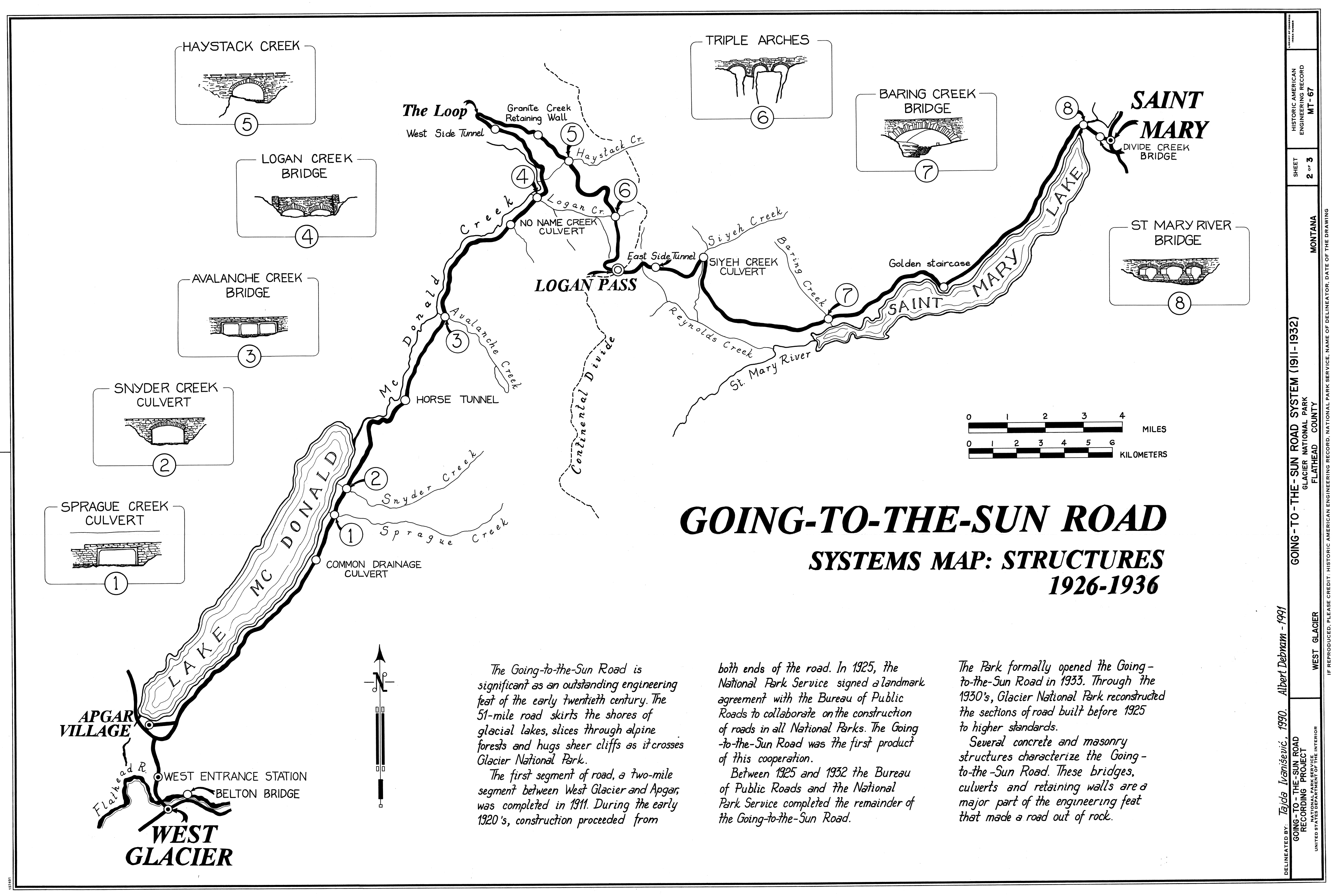
English: Map of the Going to the Sun Road, with details of bridges and culverts, designed to fit into the landscape.
|
|||||
| Date | 1990/91 | |||||
| Source | Historic American Buildings Survey - http://memory.loc.gov/pnp/habshaer/mt/mt0200/mt0242/sheet/00002a.tif | |||||
| Author | Historic American Buildings Survey | |||||
| Permission (Reusing this file) |
|


|
This map image could be re-created using vector graphics as an SVG file. This has several advantages; see Commons:Media for cleanup for more information. If an SVG form of this image is available, please upload it and afterwards replace this template with
{{vector version available|new image name}}.
It is recommended to name the SVG file “Glac gttsr map with structures.svg”—then the template Vector version available (or Vva) does not need the new image name parameter. |
File history
Click on a date/time to view the file as it appeared at that time.
| Date/Time | Thumbnail | Dimensions | User | Comment | |
|---|---|---|---|---|---|
| current | 20:56, 27 March 2009 | | 4,096 × 2,751 (926 KB) | H-stt | {{Information |Description= Glacier National Park, Montana, USA. Map of the Going-to-the-sun road, with details of bridges and culverts, designed to fit into the landscape. As designed in 1924 by Frank Kittredge. |Source= Historic American Buildings Surv |
File usage
The following pages on the English Wikipedia use this file (pages on other projects are not listed):