
File:Gibraltar map-en-edit1.svg

Size of this PNG preview of this SVG file: 385 × 598 pixels. Other resolutions: 154 × 240 pixels | 309 × 480 pixels | 494 × 768 pixels | 659 × 1,024 pixels | 1,317 × 2,048 pixels | 2,020 × 3,140 pixels.
Original file (SVG file, nominally 2,020 × 3,140 pixels, file size: 553 KB)
| This is a file from the Wikimedia Commons. Information from its description page there is shown below. Commons is a freely licensed media file repository. You can help. |
Summary
This W3C-unspecified vector image was created with Inkscape .
| Camera location | | View this and other nearby images on: OpenStreetMap |
|---|
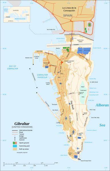
| Description | Map in English of Gibraltar |
| Date | |
| Source |
adapted from: Image:Gibraltar map-en.svg Map created using screenshots of Google Earth satellite imagery from a point of view located at 1.18 km of altitude (available imagery of November 2007) ; Other references : * CIA map ; * Gibnet map ; * U.K. MoD map Locator map : Image:Blank_map_of_South_Europe_and_North_Africa.svg (modified) created by Historicair ; Approximate scale : 1:40,000 (accuracy : about 10 m) Note : The roads width is proportional to reality |
| Author | Original by Eric Gaba (Sting), label/legend edits by Jeff Dahl |
| Permission (Reusing this file) |
Attribution and Share-Alike required |
| Other versions | Español, Français |
Français : * Sujet : Carte en anglais de Gibraltar ;
- Sources : Création personnelle ;
- Carte créée à partir de captures d'écran d'images satellite de Google Earth d'un point de vue placé à 1,18 km d'altitude (imagerie disponible de novembre 2007) ;
- Références complémentaires :
- Carte de la CIA ;
- Carte de Gibnet ;
- Carte du Ministère de la Défense britannique ;
- Carte de localisation : Image:Blank_map_of_South_Europe_and_North_Africa.svg (modifiée) crée par Historicair ;
- Échelle approximative : 1:40 000 (précision : environ 10 m) ;
- Note : Largeur du tracé des routes proportionnelle à la réalité ;
- Auteur : Eric Gaba (fr:Sting) ;
- Date : Novembre 2007.

|
This SVG file contains embedded text that can be translated into your language, using any capable SVG editor, text editor or the SVG Translate tool. For more information see: About translating SVG files. |
Licensing
I, the copyright holder of this work, hereby publish it under the following licenses:

|
Permission is granted to copy, distribute and/or modify this document under the terms of the GNU Free Documentation License, Version 1.2 or any later version published by the Free Software Foundation; with no Invariant Sections, no Front-Cover Texts, and no Back-Cover Texts. A copy of the license is included in the section entitled GNU Free Documentation License. |
This file is licensed under the Creative Commons Attribution-Share Alike Attribution-Share Alike 4.0 International, 3.0 Unported, 2.5 Generic, 2.0 Generic and 1.0 Generic license.
- You are free:
- to share – to copy, distribute and transmit the work
- to remix – to adapt the work
- Under the following conditions:
- attribution – You must give appropriate credit, provide a link to the license, and indicate if changes were made. You may do so in any reasonable manner, but not in any way that suggests the licensor endorses you or your use.
- share alike – If you remix, transform, or build upon the material, you must distribute your contributions under the same or compatible license as the original.
You may select the license of your choice.
File history
Click on a date/time to view the file as it appeared at that time.
| Date/Time | Thumbnail | Dimensions | User | Comment | |
|---|---|---|---|---|---|
| current | 17:43, 10 December 2007 | | 2,020 × 3,140 (553 KB) | Jeff Dahl | fx spelling - correct version |
| 17:40, 10 December 2007 |  | 2,020 × 3,140 (553 KB) | Jeff Dahl | Reverted to version as of 04:31, 8 December 2007-wrong version uploaded | |
| 17:07, 10 December 2007 |  | 1,000 × 1,558 (555 KB) | Jeff Dahl | fx spelling | |
| 04:31, 8 December 2007 |  | 2,020 × 3,140 (553 KB) | Jeff Dahl | Added Ibrahim al-Ibrahim Mosque | |
| 04:13, 8 December 2007 |  | 2,020 × 3,140 (552 KB) | Jeff Dahl | {{inkscape}} {{Location|36|08|00|N|5|21|00|W|type:city_scale:50000}} {{Information |Description=Map in English of Gibraltar |Source=adapted from: Image:Gibraltar map-en.svg <br/>Map created using screenshots of [[:en:Google Ea |
File usage
The following pages on the English Wikipedia use this file (pages on other projects are not listed):