
File:Gc01.jpg
Size of this preview: 550 × 599 pixels. Other resolutions: 220 × 240 pixels | 441 × 480 pixels | 705 × 768 pixels | 940 × 1,024 pixels | 1,880 × 2,048 pixels | 4,135 × 4,505 pixels.
Original file (4,135 × 4,505 pixels, file size: 3.85 MB, MIME type: image/jpeg)
| This is a file from the Wikimedia Commons. Information from its description page there is shown below. Commons is a freely licensed media file repository. You can help. |
Summary
| Description |
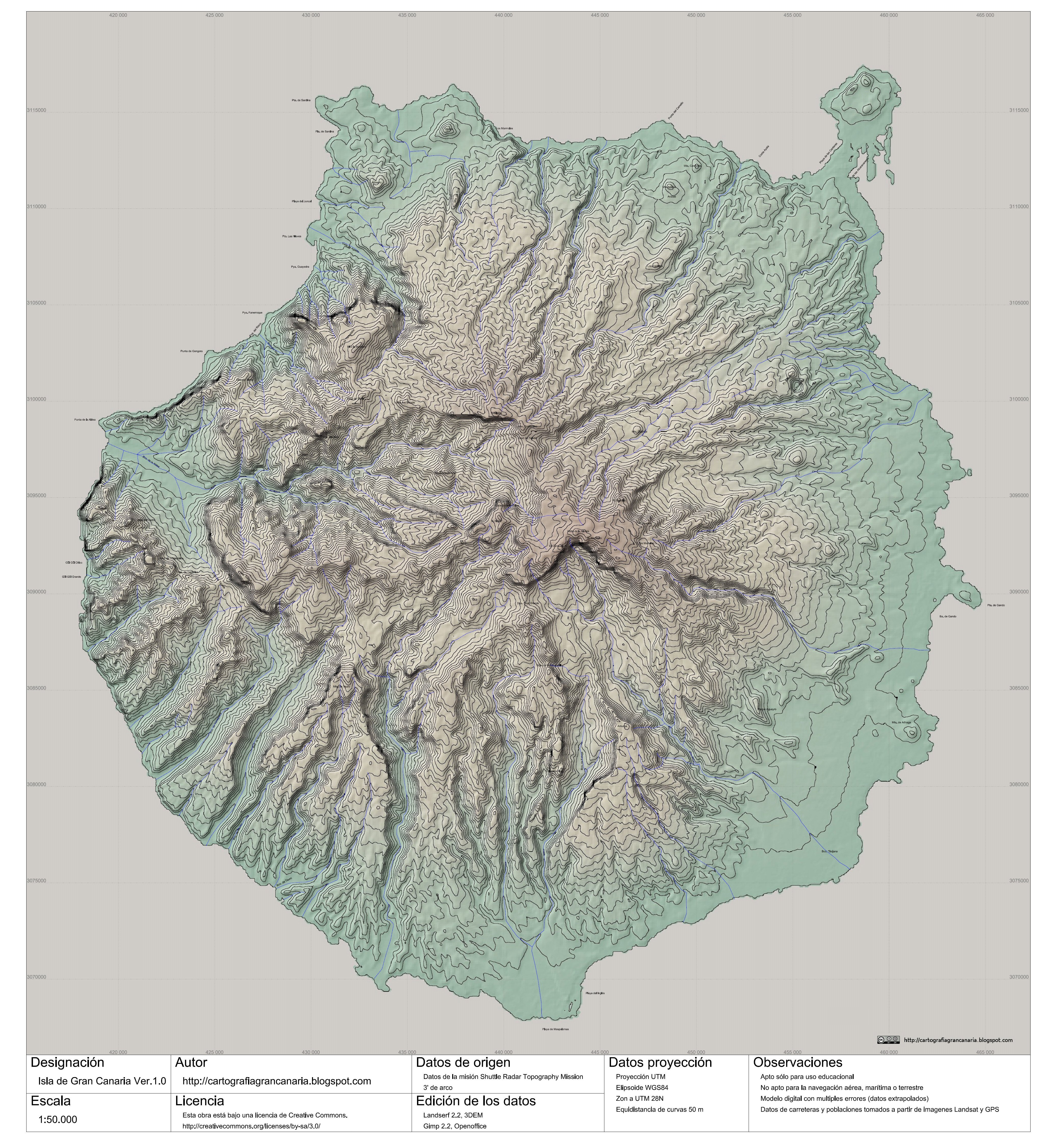
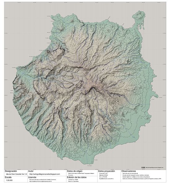
English: Topographic map of the Gran Canaria Island (Canary Islands) Spain. Scale 1:50.000.
Español: mapa topográfico de la isla de Gran Canaria (Islas Canarias) España. Escala 1:50.000.
|
| Date | |
| Source | http://cartografiagrancanaria.blogspot.com/2007/10/gran-canaria-150000-para-la-wikipedia.html |
| Author | Cartografiagrancanaria @ Cartografiagrancanaria.blogspot.com. |
| Permission (Reusing this file) |
This file is licensed under the Creative Commons Attribution-Share Alike 3.0 Unported license.
English: Notes: Educative use only. Use nonallowed for the airplane navigation, marine or terrestrial. Digital model with multiple errors. Data of roads and populations taken from Landsat images and GPS.
Español: Observaciones: Apto sólo para uso educacional. No apto para la navegación aérea, marítima o terrestre. Modelo digital con múltiples errores. Datos de carreteras y poblaciones tomados a partir de imágenes Landsat y GPS. |
| Other versions | Cropped & without watermark: Image:Gc01 cropped&no watermark.jpg |

|
This file has been superseded by Gc01 cropped&no watermark.jpg. It is recommended to use the other file. Please note that deleting superseded images requires consent. Reason to use the other file: "image without watermarks"
|

|
File history
Click on a date/time to view the file as it appeared at that time.
| Date/Time | Thumbnail | Dimensions | User | Comment | |
|---|---|---|---|---|---|
| current | 19:16, 6 October 2007 | | 4,135 × 4,505 (3.85 MB) | Cartografiagrancanaria | |
| 18:17, 5 October 2007 |  | 4,135 × 4,505 (3.86 MB) | Cartografiagrancanaria | {{Information |Description= |Source=self-made |Date= |Author= Cartografiagrancanaria }} |
File usage
The following pages on the English Wikipedia use this file (pages on other projects are not listed):
Global file usage
The following other wikis use this file:
- Usage on ca.wikipedia.org
- Usage on hr.wikipedia.org
- Usage on hu.wikipedia.org
- Usage on ms.wikipedia.org
- Usage on nn.wikipedia.org
- Usage on pt.wikipedia.org
- Usage on tr.wikipedia.org
- Usage on yo.wikipedia.org