
File:Gate on the Angles Way - geograph.org.uk - 1484314.jpg
No higher resolution available.
Gate_on_the_Angles_Way_-_geograph.org.uk_-_1484314.jpg (640 × 503 pixels, file size: 101 KB, MIME type: image/jpeg)
| This is a file from the Wikimedia Commons. Information from its description page there is shown below. Commons is a freely licensed media file repository. You can help. |
Summary
| Description |
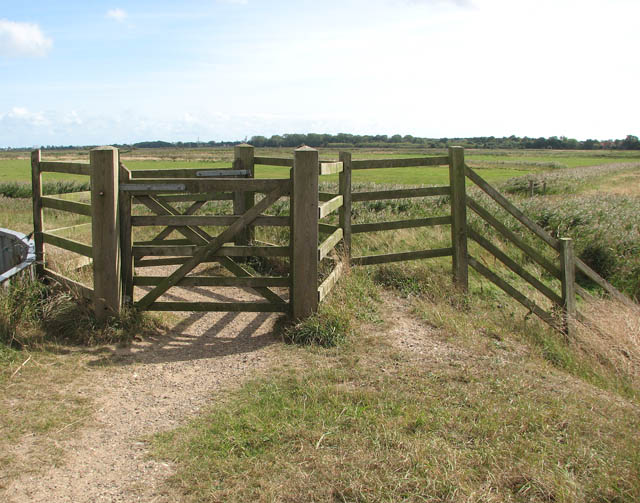
English: Gate on the Angles Way Burgh Castle Marshes can be seen beyond. In combination with the Peddars Way, Norfolk Coast Path and Weavers' Way, the Angles Way forms the 227-mile Around Norfolk Walk. The route leads from Great Yarmouth by Breydon Water, along and near the River Waveney, passing around Oulton Broad, Beccles and Bungay, and Harleston and Diss, and then by the Little Ouse and onwards through heathland and marsh to Knettishall Heath in the Suffolk Brecks. Less than a mile distant to the west across the heath is the start of the Peddars Way and finish of the Icknield Way Path. At Bungay, there is a link into the waymarked Bigod Way (10 miles) which is a circular route around the town, the site of Bigod's Castle. |
| Date | |
| Source | From geograph.org.uk |
| Author | Evelyn Simak |
| Attribution (required by the license) | Evelyn Simak / Gate on the Angles Way / |
| Camera location | | View this and other nearby images on: OpenStreetMap |
|---|
_heading:90.00&language=en)
| Object location | | View this and other nearby images on: OpenStreetMap |
|---|
_heading:90.00&language=en)
Licensing

|
This image was taken from the Geograph project collection. See this photograph's page on the Geograph website for the photographer's contact details. The copyright on this image is owned by Evelyn Simak and is licensed for reuse under the Creative Commons Attribution-ShareAlike 2.0 license.
|
This file is licensed under the Creative Commons Attribution-Share Alike 2.0 Generic license.
Attribution: Evelyn Simak
- You are free:
- to share – to copy, distribute and transmit the work
- to remix – to adapt the work
- Under the following conditions:
- attribution – You must give appropriate credit, provide a link to the license, and indicate if changes were made. You may do so in any reasonable manner, but not in any way that suggests the licensor endorses you or your use.
- share alike – If you remix, transform, or build upon the material, you must distribute your contributions under the same or compatible license as the original.
File history
Click on a date/time to view the file as it appeared at that time.
| Date/Time | Thumbnail | Dimensions | User | Comment | |
|---|---|---|---|---|---|
| current | 14:46, 2 March 2011 | | 640 × 503 (101 KB) | GeographBot | == {{int:filedesc}} == {{Information |description={{en|1=Gate on the Angles Way Burgh Castle Marshes can be seen beyond. In combination with the Peddars Way, Norfolk Coast Path and Weavers' Way, the Angles Way forms the 227-mile Around Norfolk Walk. The |
File usage
The following pages on the English Wikipedia use this file (pages on other projects are not listed):