
File:Gallia cisalpina - Shepherd png.png

Original file (1,722 × 882 pixels, file size: 3.64 MB, MIME type: image/png)
| This is a file from the Wikimedia Commons. Information from its description page there is shown below. Commons is a freely licensed media file repository. You can help. |
Summary
| Description |
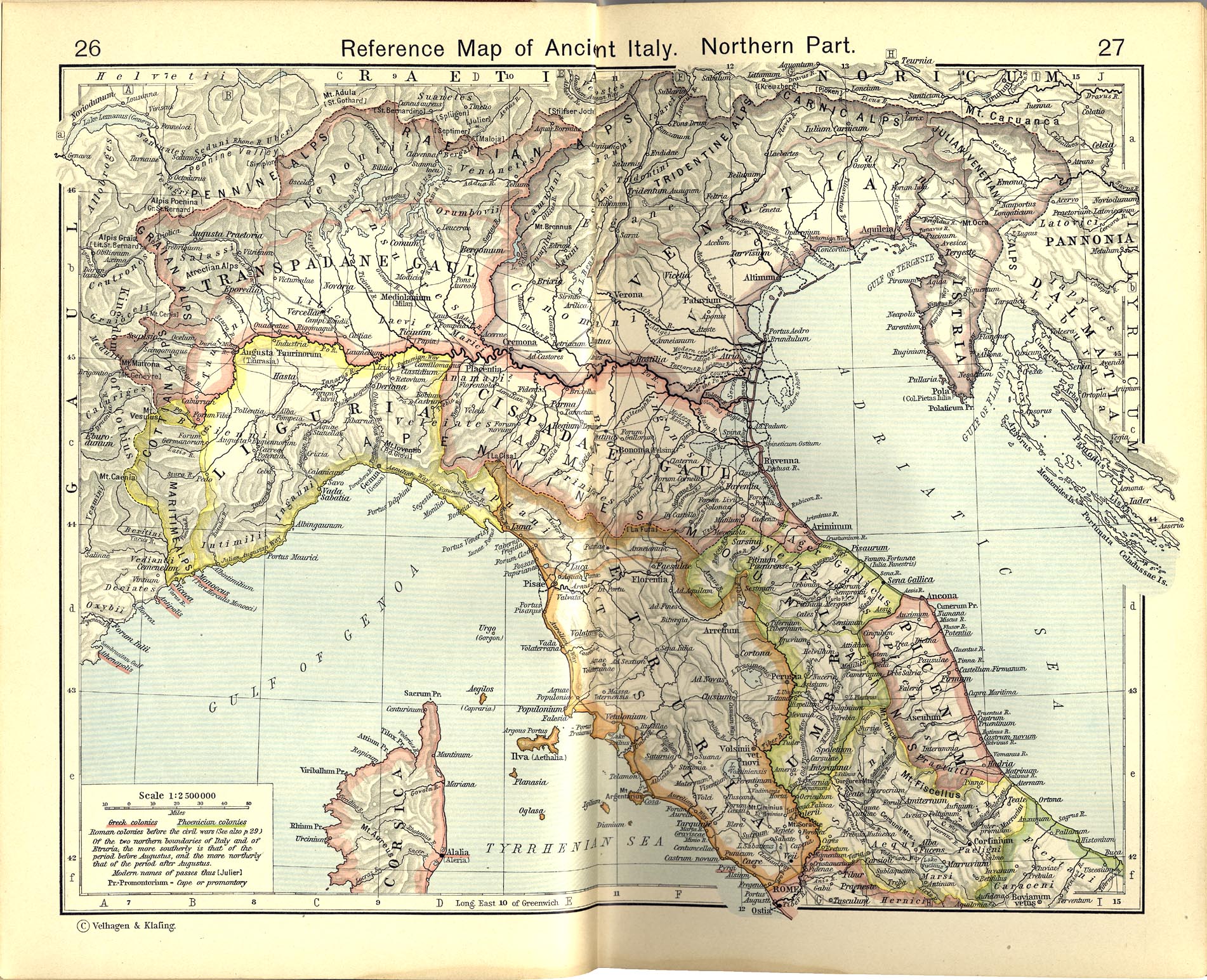
Italiano: Territori della Gallia cisalpina attorno agli inizi del I secolo a.C.
Historical Atlas by William R. Shepherd, 1911. Courtesy of the University of Texas Libraries, The University of Texas at Austin. From The Historical Atlas by William R. Shepherd, 1911 edition |
|||||
| Date | ||||||
| Source | File:Shepherd Map of Ancient Italy, Northern Part.jpg | |||||
| Author |
Historical Atlas by William R. Shepherd 1911 edition
Reference: Reference Map of Ancient Italy, Northern Part Courtesy of the University of Texas Libraries, The University of Texas at Austin. [1] |
|||||
| Permission (Reusing this file) |
|
|||||

![[1]](http://www.lib.utexas.edu/maps/historical/shepherd/italy_ancient_south.jpg)
Original upload log
This image is a derivative work of the following images:File:Shepherd Map of Ancient Italy, Northern Part.jpg
10:05, 2007 July 1 user:Accurimbono . . (366 bytes) (+366) . . (== Summary == Map of South Italy during the Roman period. Extracted from The Historical Atlas by William R. Shepherd, 1911. Original image is at http://www.lib.utexas.edu/maps/historical/shepherd_1911/shepherd-c-026-027.jpg
This media file is in the public domain in the United States. This applies to U.S. works where the copyright has expired, often because its first publication occurred prior to January 1, 1929, and if not then due to lack of notice or renewal. See this page for further explanation.
|
 | |
 |
This image might not be in the public domain outside of the United States; this especially applies in the countries and areas that do not apply the rule of the shorter term for US works, such as Canada, Mainland China (not Hong Kong or Macao), Germany, Mexico, and Switzerland. The creator and year of publication are essential information and must be provided. See Wikipedia:Public domain and Wikipedia:Copyrights for more details.
|
File history
Click on a date/time to view the file as it appeared at that time.
| Date/Time | Thumbnail | Dimensions | User | Comment | |
|---|---|---|---|---|---|
| current | 11:32, 9 November 2012 | | 1,722 × 882 (3.64 MB) | Cristiano64 | Gallia Cisalpina included also (in I century BC): Liguria and Venetia |
| 07:28, 15 October 2012 |  | 1,722 × 882 (3.67 MB) | Cristiano64 | User created page with UploadWizard |
File usage
Global file usage
The following other wikis use this file:
- Usage on bg.wikipedia.org
- Usage on ca.wikipedia.org
- Usage on da.wikipedia.org
- Usage on et.wikipedia.org
- Usage on fa.wikipedia.org
- Usage on fi.wikipedia.org
- Usage on fr.wikipedia.org
- Usage on hu.wikipedia.org
- Usage on it.wikipedia.org
- Usage on ja.wikipedia.org
- Usage on pt.wikipedia.org
- Usage on sh.wikipedia.org
- Usage on www.wikidata.org