
File:Frenchbroadrivermap.png
No higher resolution available.
Frenchbroadrivermap.png (500 × 500 pixels, file size: 402 KB, MIME type: image/png)
| This is a file from the Wikimedia Commons. Information from its description page there is shown below. Commons is a freely licensed media file repository. You can help. |
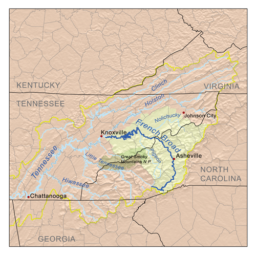
| Description | Map of the French Broad River watershed. |
| Date | |
| Source | Self-made, based on USGS data. |
| Author | Kmusser |
| Permission (Reusing this file) |
I, the copyright holder of this work, hereby publish it under the following license: This file is licensed under the Creative Commons Attribution-Share Alike 2.5 Generic license.
|
File history
Click on a date/time to view the file as it appeared at that time.
| Date/Time | Thumbnail | Dimensions | User | Comment | |
|---|---|---|---|---|---|
| current | 19:24, 3 May 2007 | | 500 × 500 (402 KB) | Kmusser | {{Information |Description=Map of the French Broad River watershed. |Source=Self-made, based on USGS data. |Date=May 3, 2007 |Author= Kmusser }} {{self|cc-by-sa-2.5}} [[Category:Maps of rivers of th |
File usage
The following pages on the English Wikipedia use this file (pages on other projects are not listed):
Global file usage
The following other wikis use this file:
- Usage on de.wikipedia.org
- Usage on es.wikipedia.org
- Usage on fr.wikipedia.org
- Usage on hu.wikipedia.org
- Usage on ru.wikipedia.org
- Usage on www.wikidata.org