
File:Franklin Av IRT WB plat east jeh.JPG

Size of this preview: 762 × 600 pixels. Other resolutions: 305 × 240 pixels | 610 × 480 pixels | 976 × 768 pixels | 1,280 × 1,007 pixels | 2,560 × 2,014 pixels | 3,726 × 2,932 pixels.
Original file (3,726 × 2,932 pixels, file size: 1.69 MB, MIME type: image/jpeg)
| This is a file from the Wikimedia Commons. Information from its description page there is shown below. Commons is a freely licensed media file repository. You can help. |
Summary
| Description |
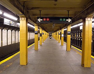
English: Looking east along west (RR north) bound platform of Franklin Avenue – Botanic Garden station. |
| Date | Taken on 12 December 2009 |
| Source | Own work |
| Author | Jim.henderson |
| Camera location | | View this and other nearby images on: OpenStreetMap |
|---|
Licensing
| This file is made available under the Creative Commons CC0 1.0 Universal Public Domain Dedication. | |
| The person who associated a work with this deed has dedicated the work to the public domain by waiving all of their rights to the work worldwide under copyright law, including all related and neighboring rights, to the extent allowed by law. You can copy, modify, distribute and perform the work, even for commercial purposes, all without asking permission.
|
File history
Click on a date/time to view the file as it appeared at that time.
| Date/Time | Thumbnail | Dimensions | User | Comment | |
|---|---|---|---|---|---|
| current | 17:45, 2 January 2010 | | 3,726 × 2,932 (1.69 MB) | Jim.henderson | {{Information |Description={{en|1=Looking east along east (RR south) bound platform of IRT Franklin Avenue. Category:IRT Eastern Parkway Line}} |Source=Own work |Author=Jim.henderson |Date=2009-12 |Permission= |other_versions= } |
File usage
The following pages on the English Wikipedia use this file (pages on other projects are not listed):
Global file usage
The following other wikis use this file:
- Usage on ja.wikipedia.org
- Usage on pl.wikipedia.org
- Usage on ru.wikipedia.org
- Usage on zh.wikipedia.org