
File:Fort boyard vue aérienne.jpg

Size of this preview: 512 × 600 pixels. Other resolutions: 205 × 240 pixels | 410 × 480 pixels | 683 × 800 pixels.
Original file (683 × 800 pixels, file size: 115 KB, MIME type: image/jpeg)
| This is a file from the Wikimedia Commons. Information from its description page there is shown below. Commons is a freely licensed media file repository. You can help. |
| Description |
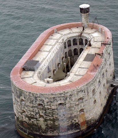
English: Fort Boyard - view from helicopter
Deutsch: Fort Boyard - vom Helikopter aus gesehen
Français : Fort Boyard, pris par photo aérienne depuis hélicoptère
Suomi: Fort Boyard - helikopterista kuvattuna
Русский: Форт Байяр — вид с вертолёта |
||||||||
| Date | |||||||||
| Source | fr.wikipedia.org: 9 mai 2005 à 13:18 . . Lapi . . 683x800 (118197 octets) (photo prise par moi même en août 2004 depuis un hélicoptère robinson) | ||||||||
| Author | Lapi | ||||||||
| Permission (Reusing this file) |
|

| Camera location | | View this and other nearby images on: OpenStreetMap |
|---|
File history
Click on a date/time to view the file as it appeared at that time.
| Date/Time | Thumbnail | Dimensions | User | Comment | |
|---|---|---|---|---|---|
| current | 23:19, 22 December 2005 | | 683 × 800 (115 KB) | BLueFiSH.as | *{{en|Fort Boyard - view from helicopter}} *{{de|Fort Boyard - vom Helikopter aus gesehen}} *photo taken by fr:User:Lapi in 2004-08 *Source: [[:fr:Image:{{subst:PAGENAME}}|fr.wikipedia.org]]: ''<nowiki>9 mai 2005 à 13:18 . . Lapi . . 683x80 |
File usage
The following pages on the English Wikipedia use this file (pages on other projects are not listed):
Global file usage
The following other wikis use this file:
- Usage on ar.wikipedia.org
- Usage on da.wikipedia.org
- Usage on de.wikipedia.org
- Usage on de.wikivoyage.org
- Usage on es.wikipedia.org
- Usage on fa.wikipedia.org
- Usage on fi.wikipedia.org
- Usage on fr.wikipedia.org
- Usage on fr.wikinews.org
- Usage on he.wikipedia.org
- Usage on he.wikivoyage.org
- Usage on hu.wikipedia.org
- Usage on it.wikipedia.org
- Usage on nl.wikipedia.org
- Usage on no.wikipedia.org
- Usage on pt.wikipedia.org
- Usage on ru.wikipedia.org
- Usage on sk.wikipedia.org
- Usage on sr.wikipedia.org
- Usage on sv.wikipedia.org
- Usage on ta.wiktionary.org
- Usage on uk.wikiquote.org
- Usage on www.wikidata.org