
File:Former Toll House - Kersal.jpg
Size of this preview: 800 × 600 pixels. Other resolutions: 320 × 240 pixels | 640 × 480 pixels | 1,024 × 768 pixels | 1,280 × 960 pixels | 1,600 × 1,200 pixels.
Original file (1,600 × 1,200 pixels, file size: 706 KB, MIME type: image/jpeg)
| This is a file from the Wikimedia Commons. Information from its description page there is shown below. Commons is a freely licensed media file repository. You can help. |
| Camera location | | View this and other nearby images on: OpenStreetMap |
|---|
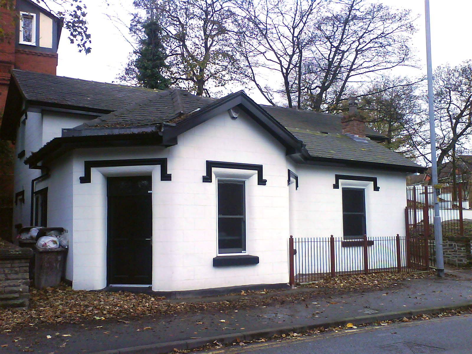
| Description | The former toll collector's house, Bury New Road, Kersal | ||
| Date | |||
| Source | User:Richerman | ||
| Author | User:Richerman | ||
| Permission (Reusing this file) |
I, the copyright holder of this work, hereby publish it under the following licenses:
This file is licensed under the Creative Commons Attribution-Share Alike 3.0 Unported, 2.5 Generic, 2.0 Generic and 1.0 Generic license.
You may select the license of your choice. |

Original upload log
The original description page was here. All following user names refer to en.wikipedia.
| Upload date | User | Bytes | Dimensions | Comment |
|---|---|---|---|---|
| 2008-12-24 22:12:02 | Parrot of Doom | 722703 | 1600×1200 | Corrected white balance |
| 2007-11-11 22:07:01 | Richerman | 461931 | 1600×1200 | The former toll collector's house, Bury New Road, Kersal |
File history
Click on a date/time to view the file as it appeared at that time.
| Date/Time | Thumbnail | Dimensions | User | Comment | |
|---|---|---|---|---|---|
| current | 14:22, 27 December 2008 | | 1,600 × 1,200 (706 KB) | Parrot of Doom | {{Location dec|53.514859|-2.269107|type:landmark_region:DE-NI_scale:5000}} {{Information |Description=The former toll collector's house, Bury New Road, Kersal |Source=User:Richerman |Date=11 November 2007 |Author=User:Richerman |Permission={{self| |
File usage
The following pages on the English Wikipedia use this file (pages on other projects are not listed):
Global file usage
The following other wikis use this file:
- Usage on www.wikidata.org