
File:Fixed gulf map.png
No higher resolution available.
Fixed_gulf_map.png (734 × 600 pixels, file size: 1,001 KB, MIME type: image/png)
| This is a file from the Wikimedia Commons. Information from its description page there is shown below. Commons is a freely licensed media file repository. You can help. |
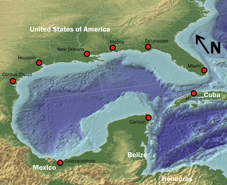
Summary
| Description |
English: "The Gulf of Mexico in 3D perspective. A GIS can create very accurate and realistic-looking environments." |
| Source | Source (High-Res: 3000x2451) |
| Author | NOAA |
| Permission (Reusing this file) |
Public domain |
| Other versions |
 |
Licensing
This image is in the public domain because it contains materials that originally came from the U.S. National Oceanic and Atmospheric Administration, taken or made as part of an employee's official duties.
|
File history
Click on a date/time to view the file as it appeared at that time.
| Date/Time | Thumbnail | Dimensions | User | Comment | |
|---|---|---|---|---|---|
| current | 04:07, 4 May 2010 | | 734 × 600 (1,001 KB) | GatorSlayerFSU | {{Information |Description={{en|1=Fixed the gap in pic}} |Source=Public Domain |Author=GatorSlayerFSU |Date=5/4/10 |Permission= |other_versions= }} |
File usage
The following pages on the English Wikipedia use this file (pages on other projects are not listed):
Global file usage
The following other wikis use this file:
- Usage on arc.wikipedia.org
- Usage on azb.wikipedia.org
- Usage on az.wikipedia.org
- Usage on bg.wikipedia.org
- Usage on bn.wikipedia.org
- Usage on ckb.wikipedia.org
- Usage on cs.wikipedia.org
- Usage on de.wikipedia.org
- Usage on fa.wikipedia.org
- Usage on fi.wiktionary.org
- Usage on fo.wikipedia.org
- Usage on fr.wikipedia.org
- Usage on fy.wikipedia.org
- Usage on gl.wikipedia.org
- Usage on hak.wikipedia.org
- Usage on he.wikipedia.org
- Usage on hi.wikipedia.org
- Usage on hr.wikipedia.org
- Usage on ilo.wikipedia.org
- Usage on is.wikipedia.org
- Usage on ka.wikipedia.org
- Usage on lb.wikipedia.org
- Usage on lfn.wikipedia.org
- Usage on mk.wikipedia.org
- Usage on ml.wikipedia.org
- Usage on mn.wikipedia.org
- Usage on mr.wikipedia.org
- Usage on ms.wikipedia.org
- Usage on ne.wikipedia.org
- Usage on pa.wikipedia.org
- Usage on ru.wikipedia.org
- Usage on sco.wikipedia.org
- Usage on sq.wikipedia.org
- Usage on sr.wikipedia.org
- Usage on ta.wikipedia.org
- Usage on tl.wikipedia.org
- Usage on vi.wikipedia.org
- Usage on www.wikidata.org
- Usage on zh.wikipedia.org