
File:Feltham, A312 Uxbridge Road - geograph.org.uk - 1161633.jpg
No higher resolution available.
Feltham,_A312_Uxbridge_Road_-_geograph.org.uk_-_1161633.jpg (640 × 480 pixels, file size: 79 KB, MIME type: image/jpeg)
| This is a file from the Wikimedia Commons. Information from its description page there is shown below. Commons is a freely licensed media file repository. You can help. |
Summary
| Description |
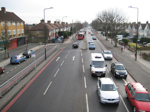
English: Feltham: A312 Uxbridge Road Between the wars semi-detached houses line this busy road, viewed from the Browells Lane / Boundaries Road footbridge. The double red lines at either side of the road, and indeed on the slip road too, indicate that this a Red Route Urban Clearway. The bus is on Route 285 from Heathrow Airport to Kingston-upon-Thames. |
| Date | |
| Source | From geograph.org.uk |
| Author | Nigel Cox |
| Attribution (required by the license) | Nigel Cox / Feltham: A312 Uxbridge Road / |
| Camera location | | View this and other nearby images on: OpenStreetMap |
|---|
_heading:112.00&language=en)
| Object location | | View this and other nearby images on: OpenStreetMap |
|---|
_heading:112.00&language=en)
Licensing

|
This image was taken from the Geograph project collection. See this photograph's page on the Geograph website for the photographer's contact details. The copyright on this image is owned by Nigel Cox and is licensed for reuse under the Creative Commons Attribution-ShareAlike 2.0 license.
|
This file is licensed under the Creative Commons Attribution-Share Alike 2.0 Generic license.
Attribution: Nigel Cox
- You are free:
- to share – to copy, distribute and transmit the work
- to remix – to adapt the work
- Under the following conditions:
- attribution – You must give appropriate credit, provide a link to the license, and indicate if changes were made. You may do so in any reasonable manner, but not in any way that suggests the licensor endorses you or your use.
- share alike – If you remix, transform, or build upon the material, you must distribute your contributions under the same or compatible license as the original.
File history
Click on a date/time to view the file as it appeared at that time.
| Date/Time | Thumbnail | Dimensions | User | Comment | |
|---|---|---|---|---|---|
| current | 13:37, 25 February 2011 | | 640 × 480 (79 KB) | GeographBot | == {{int:filedesc}} == {{Information |description={{en|1=Feltham: A312 Uxbridge Road Between the wars semi-detached houses line this busy road, viewed from the Browells Lane / Boundaries Road footbridge. The double red lines at either side of the road, an |
File usage
The following pages on the English Wikipedia use this file (pages on other projects are not listed):