
File:Faxonius lancifer Shrimp Crayfish.jpg

Original file (2,048 × 1,536 pixels, file size: 515 KB, MIME type: image/jpeg)
| This is a file from the Wikimedia Commons. Information from its description page there is shown below. Commons is a freely licensed media file repository. You can help. |
Summary
| Description |
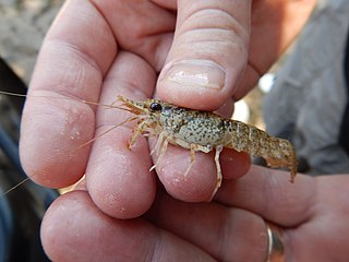
English: Photo 2236836, (c) fishesoftexas, some rights reserved (CC BY-SA)
Original Attribution © fishesoftexas Cc by sa small some rights reserved Uploaded by fishesoftexas fishesoftexas Source iNaturalist Original http://www.inaturalist.org/photos/2236836 Associated observations Square 3 photos Faxonius lancifer Shrimp Crayfish Observer fishesoftexas Date August 3, 2015 11:10 AM CDT Place Hardin County, US-TX, US (Google, OSM) 2 comments 1 ID Research Grade View Associated taxa Shrimp Crayfish - Photo (c) fishesoftexas, some rights reserved (CC BY-SA) CC Faxonius lancifer (Shrimp Crayfish) Shrimp Crayfish - Photo (c) fishesoftexas, some rights reserved (CC BY-SA) CC Orconectes lancifer [inactive] (Shrimp Crayfish) Sizes small medium large original Width 4608 Height 3456 Bits 8 Comment Make NIKON Model COOLPIX AW120 Orientation 1 X resolution 300/1 Y resolution 300/1 Resolution unit 2 Software COOLPIX AW120V1.0 Date time 2015-08-03 11:25:32 -0700 Ycb cr positioning 2 Exposure time 1/200 F number 14/5 Exposure program 2 Iso speed ratings 125 Date time original 2015-08-03 11:25:32 -0700 Date time digitized 2015-08-03 11:25:32 -0700 Compressed bits per pixel 2/1 Exposure bias value 0/1 Max aperture value 3/1 Metering mode 5 Light source 0 Flash 16 Focal length 43/10 User comment Color space 1 Pixel x dimension 4608 Pixel y dimension 3456 Custom rendered 0 Exposure mode 0 White balance 0 Digital zoom ratio 0/1 Focal length in 35mm film 24 Scene capture type 0 Gain control 0 Contrast 0 Saturation 0 Sharpness 0 Subject distance range 1 GPS version �� GPS latitude ref GPS latitude NaN GPS longitude ref GPS longitude NaN GPS altitude ref GPS altitude NaN GPS time stamp [NaN, NaN, NaN] GPS satellites GPS img direction ref GPS img direction NaN GPS map datum GPS date stamp |
| Date | |
| Source | https://www.inaturalist.org/photos/2236836?size=original |
| Author | fishesoftexas |
| Camera location | | View this and other nearby images on: OpenStreetMap |
|---|
| This media file is part of an observation on iNaturalist: inaturalist.org/observations/1840875 This tag does not indicate the copyright status of the attached work. A normal copyright tag is still required. See Commons:Licensing. |
Licensing
- You are free:
- to share – to copy, distribute and transmit the work
- to remix – to adapt the work
- Under the following conditions:
- attribution – You must give appropriate credit, provide a link to the license, and indicate if changes were made. You may do so in any reasonable manner, but not in any way that suggests the licensor endorses you or your use.
- share alike – If you remix, transform, or build upon the material, you must distribute your contributions under the same or compatible license as the original.
| This image was originally posted to iNaturalist by fishesoftexas at https://www.inaturalist.org/photos/2236836. It was reviewed on 23 July 2020 by iNaturalistReviewBot and found to be published under the terms of the Cc-by-sa-4.0 license. |
File history
Click on a date/time to view the file as it appeared at that time.
| Date/Time | Thumbnail | Dimensions | User | Comment | |
|---|---|---|---|---|---|
| current | 19:40, 23 January 2020 | | 2,048 × 1,536 (515 KB) | Awkwafaba | User created page with UploadWizard |
File usage
Global file usage
The following other wikis use this file:
- Usage on ceb.wikipedia.org
- Usage on fr.wikipedia.org
- Usage on no.wikipedia.org
- Usage on sv.wikipedia.org
- Usage on www.wikidata.org