
File:Europe-south-west-kingdoms12th.png
Size of this preview: 766 × 600 pixels. Other resolutions: 307 × 240 pixels | 613 × 480 pixels | 834 × 653 pixels.
Original file (834 × 653 pixels, file size: 440 KB, MIME type: image/png)
| This is a file from the Wikimedia Commons. Information from its description page there is shown below. Commons is a freely licensed media file repository. You can help. |
Summary
| Description |
|
| Date | 21 March 2009 (original upload date) |
| Source | Transferred from gl.wikipedia to Commons. |
| Author | The original uploader was Alexandre Vigo at Galician Wikipedia. |
Licensing

|
Permission is granted to copy, distribute and/or modify this document under the terms of the GNU Free Documentation License, Version 1.2 or any later version published by the Free Software Foundation; with no Invariant Sections, no Front-Cover Texts, and no Back-Cover Texts. A copy of the license is included in the section entitled GNU Free Documentation License. |
| This file is licensed under the Creative Commons Attribution-Share Alike 3.0 Unported license. | ||
| ||
| This licensing tag was added to this file as part of the GFDL licensing update. |
Original upload log
The original description page was here. All following user names refer to gl.wikipedia.
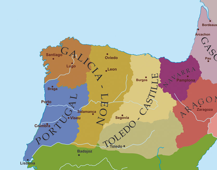
- 2009-03-21 00:02 Alexandre Vigo 834×653× (450515 bytes) Descrición/Description: Mapa político do noroeste da Península Ibérica a finais do século XII. Orixe/Source: Contido GFDL creado polo que carga o ficheiro. Autor/Author: Alexandre Vigo Copyright: Contido GFDL creado polo que carga o ficheiro. Data/Da
File history
Click on a date/time to view the file as it appeared at that time.
| Date/Time | Thumbnail | Dimensions | User | Comment | |
|---|---|---|---|---|---|
| current | 23:20, 21 March 2009 | | 834 × 653 (440 KB) | Elvire | {{Information |Description=*{{gl| Mapa político do noroeste da Península Ibérica a finais do século XII.}} *{{gl| Carte politique du nord-ouest de la péninsule ibérique à la fin du XII ème siècle.}} |Source=Transferred from [http://gl.wikipedia.o |
File usage
The following pages on the English Wikipedia use this file (pages on other projects are not listed):
Global file usage
The following other wikis use this file:
- Usage on arz.wikipedia.org
- Usage on ast.wikipedia.org
- Usage on azb.wikipedia.org
- Usage on ca.wikipedia.org
- Usage on cs.wikipedia.org
- Usage on de.wikipedia.org
- Usage on eo.wikipedia.org
- Usage on ext.wikipedia.org
- Usage on fi.wikipedia.org
- Usage on fr.wikipedia.org
- Usage on gl.wikipedia.org
- Usage on it.wikipedia.org
- Usage on la.wikipedia.org
- Usage on lv.wikipedia.org
- Usage on pt.wikipedia.org
- Usage on ru.wikipedia.org
- Usage on uk.wikipedia.org
- Usage on www.wikidata.org