
File:Erie County NY map shaded.png
Original file (708 × 636 pixels, file size: 130 KB, MIME type: image/png)
Summary[edit]
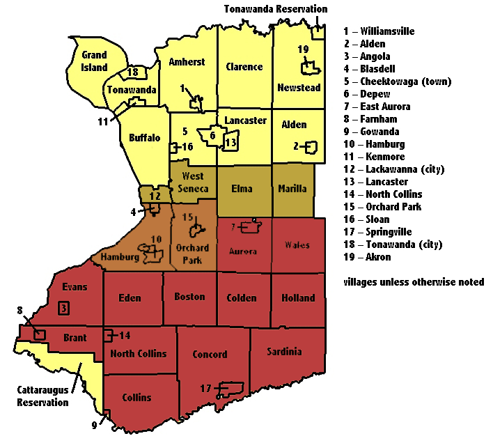
| Description |
User:CastAStone shaded a map that User:Vesperholly added text labels to Erie County map image created by User:Osgoodelawyer and/or User:Lexicon. | ||
|---|---|---|---|
| Source |
modified from the image Originally from en.wikipedia; description page is/was here. | ||
| Date |
2009-04-12 (original upload date) | ||
| Author |
| ||
| Permission (Reusing this file) |
Released under the GNU Free Documentation License.
|
Licensing[edit]
 | Permission is granted to copy, distribute and/or modify this document under the terms of the GNU Free Documentation License, Version 1.2 or any later version published by the Free Software Foundation; with no Invariant Sections, no Front-Cover Texts, and no Back-Cover Texts. |
| This work is licensed under the Creative Commons Attribution-ShareAlike 3.0 License. This licensing tag was added to this file as part of the GFDL licensing update. |
 | This file is a candidate to be copied to Wikimedia Commons.
Any user may perform this transfer; refer to Wikipedia:Moving files to Commons for details. If this file has problems with attribution, copyright, or is otherwise ineligible for Commons, then remove this tag and DO NOT transfer it; repeat violators may be blocked from editing. Other Instructions
| ||
| |||
File history
Click on a date/time to view the file as it appeared at that time.
| Date/Time | Thumbnail | Dimensions | User | Comment | |
|---|---|---|---|---|---|
| current | 17:03, 12 April 2009 | | 708 × 636 (130 KB) | CastAStone (talk | contribs) | {{Information |Description=en:User:CastAStone shaded a map that en:User:Vesperholly added text labels to [http://en.wikipedia.org/wiki/Image:Erie_County%2C_NY_Map.png Erie County map image] created by en:User:Osgoodelawyer. |Source=modified |
You cannot overwrite this file.