
File:Elsene VierVijvers Abdij.jpg

Size of this preview: 800 × 468 pixels. Other resolutions: 320 × 187 pixels | 640 × 374 pixels | 1,024 × 599 pixels | 1,500 × 877 pixels.
Original file (1,500 × 877 pixels, file size: 437 KB, MIME type: image/jpeg)
| This is a file from the Wikimedia Commons. Information from its description page there is shown below. Commons is a freely licensed media file repository. You can help. |
Summary
| Description |
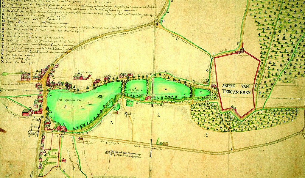
English: A Map showing Elsene circa 1750. on the right of the lakes you can see the domain of the Abbey (Abdye van Ter Kameren). On the left hand side you can see a collection of buildings, included the old mill
Nederlands: Een oude map van Elsene circa 1750. Rechts op de kaart zie je het domein van de abdij (Abdye van Ter Kameren). Links van de vijvers zie je een groep gebouwen, inclusief de oude molen |
| Date | |
| Source | Inventaris van het Bouwkundig Erfgoed van het Brussels Hoofstedelijk Gewest |
| Author | Unknown author |
| Camera location | | View this and other nearby images on: OpenStreetMap |
|---|
Licensing
|
This work is in the public domain in its country of origin and other countries and areas where the copyright term is the author's life plus 70 years or fewer. This work is in the public domain in the United States because it was published (or registered with the U.S. Copyright Office) before January 1, 1929. | |
| This file has been identified as being free of known restrictions under copyright law, including all related and neighboring rights. | |
File history
Click on a date/time to view the file as it appeared at that time.
| Date/Time | Thumbnail | Dimensions | User | Comment | |
|---|---|---|---|---|---|
| current | 13:43, 6 November 2019 | | 1,500 × 877 (437 KB) | Riverburn | User created page with UploadWizard |
File usage
The following pages on the English Wikipedia use this file (pages on other projects are not listed):