
File:Edison Sault power plant and Soo Locks 2010-04-20 USACE.jpg

Size of this preview: 800 × 532 pixels. Other resolutions: 320 × 213 pixels | 640 × 426 pixels | 1,024 × 681 pixels | 1,280 × 852 pixels | 2,560 × 1,703 pixels | 6,144 × 4,088 pixels.
Original file (6,144 × 4,088 pixels, file size: 8.93 MB, MIME type: image/jpeg)
| This is a file from the Wikimedia Commons. Information from its description page there is shown below. Commons is a freely licensed media file repository. You can help. |
| Description |
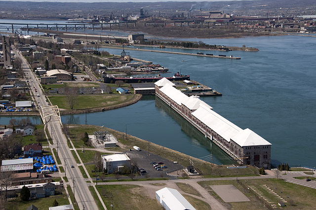
English: Edison Sault hydroelectric power plant (foreground) and the Soo Locks (background) along the St. Marys River in Sault Ste. Marie, Michigan. |
|||
| Date | ||||
| Source | US Army Corps of Engineers Digital Visual Library (DVL) [1] Photo ID: VIRIN 100420-A-9999M-939 | |||
| Author | US Army Corps of Engineers, Richard McDonald | |||
| Permission (Reusing this file) |
|
| Object location | | View this and other nearby images on: OpenStreetMap |
|---|
File history
Click on a date/time to view the file as it appeared at that time.
| Date/Time | Thumbnail | Dimensions | User | Comment | |
|---|---|---|---|---|---|
| current | 16:25, 3 September 2011 | | 6,144 × 4,088 (8.93 MB) | Life of Riley | {{Information |Description={{en|Edison Sault hydroelectric power plant (foreground) and the Soo Locks (background) along the St. Marys River in Sault Ste. Marie, Michigan.}} |Source=US Army Corps of Engineers Digital Visual Library (DVL) [https://eportal. |
File usage
The following pages on the English Wikipedia use this file (pages on other projects are not listed):
Global file usage
The following other wikis use this file:
- Usage on arz.wikipedia.org
- Usage on bn.wikipedia.org
- Usage on en.wikivoyage.org