
File:Ecclesfield East station site geograph-3450312-by-Ben-Brooksbank.jpg
Size of this preview: 800 × 502 pixels. Other resolutions: 320 × 201 pixels | 640 × 402 pixels | 1,024 × 643 pixels | 1,280 × 804 pixels | 2,314 × 1,453 pixels.
Original file (2,314 × 1,453 pixels, file size: 2.97 MB, MIME type: image/jpeg)
| This is a file from the Wikimedia Commons. Information from its description page there is shown below. Commons is a freely licensed media file repository. You can help. |
Summary
| Description |
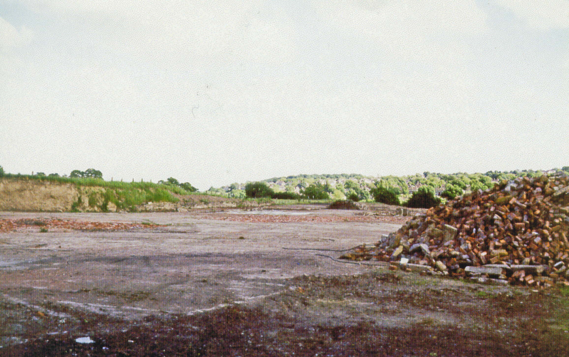
English: Site of former Ecclesfield East station, 1998. The first of the two Sheffield - Barnsley railways through the Blackburn Valley was the ex-GCR line here, with a station at Ecclesfield ('Ecclesfield Esat from 25/9/50) lasted only until 7/12/53. (The parallel ex-Midland line is still open but its Eccesfield (West) station closed in 11/67). The view over waste-ground is eastward on the road to Thorpe Common and the M1 motorway runs through just ahead. |
| Date | |
| Source | From geograph.org.uk |
| Author | Ben Brooksbank |
| Permission (Reusing this file) |
Creative Commons Attribution Share-alike license 2.0 |
| Attribution (required by the license) | Ben Brooksbank / Site of former Ecclesfield East station, 1998 / |
| Camera location | | View this and other nearby images on: OpenStreetMap |
|---|
Licensing

|
This image was taken from the Geograph project collection. See this photograph's page on the Geograph website for the photographer's contact details. The copyright on this image is owned by Ben Brooksbank and is licensed for reuse under the Creative Commons Attribution-ShareAlike 2.0 license.
|
This file is licensed under the Creative Commons Attribution-Share Alike 2.0 Generic license.
Attribution: Ben Brooksbank
- You are free:
- to share – to copy, distribute and transmit the work
- to remix – to adapt the work
- Under the following conditions:
- attribution – You must give appropriate credit, provide a link to the license, and indicate if changes were made. You may do so in any reasonable manner, but not in any way that suggests the licensor endorses you or your use.
- share alike – If you remix, transform, or build upon the material, you must distribute your contributions under the same or compatible license as the original.
File history
Click on a date/time to view the file as it appeared at that time.
| Date/Time | Thumbnail | Dimensions | User | Comment | |
|---|---|---|---|---|---|
| current | 07:45, 14 July 2013 | | 2,314 × 1,453 (2.97 MB) | Chevin | == {{int:filedesc}} == {{Information |Description={{en|1='''Site of former Ecclesfield East station, 1998.'''<br/> The first of the two Sheffield - Barnsley railways through the Blackburn Valley was the ex-GCR line here, with a station at Ecclesfield (... |
File usage
The following pages on the English Wikipedia use this file (pages on other projects are not listed):
Global file usage
The following other wikis use this file:
- Usage on www.wikidata.org