
File:Eastern-hungarian-kingdom1550.JPG

Size of this preview: 800 × 564 pixels. Other resolutions: 320 × 225 pixels | 640 × 451 pixels | 1,024 × 722 pixels | 1,280 × 902 pixels | 1,500 × 1,057 pixels.
Original file (1,500 × 1,057 pixels, file size: 576 KB, MIME type: image/jpeg)
| This is a file from the Wikimedia Commons. Information from its description page there is shown below. Commons is a freely licensed media file repository. You can help. |
Summary
| Description |
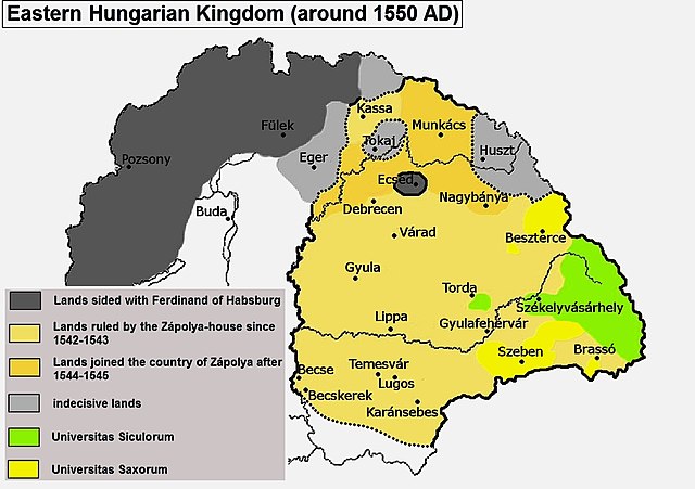
English: John Sigismund Zápolya's realm around 1550 |
| Date | 30 November 2006 (original upload date) |
| Source |
"Map 14: Transylvania and eastern Hungary in the fifteenth-seventeenth centuries" in (1994) History of Transylvania, Akadémiai Kiadó, pp. 256–257 ISBN: 978-963-05-6703-9. Transferred from en.wikipedia to Commons by Frokor using CommonsHelper. |
| Author | Fz22 at English Wikipedia |
Licensing
Fz22 at the English-language Wikipedia, the copyright holder of this work, hereby publishes it under the following license:
| This file is licensed under the Creative Commons Attribution-Share Alike 3.0 Unported license. Subject to disclaimers. | ||
| Attribution: Fz22 at the English-language Wikipedia | ||
| ||
| This licensing tag was added to this file as part of the GFDL licensing update. |

|
Permission is granted to copy, distribute and/or modify this document under the terms of the GNU Free Documentation License, Version 1.2 or any later version published by the Free Software Foundation; with no Invariant Sections, no Front-Cover Texts, and no Back-Cover Texts. A copy of the license is included in the section entitled GNU Free Documentation License. Subject to disclaimers. |
Original upload log
The original description page was here. All following user names refer to en.wikipedia.
The version of 14:20, 2 March 2013 was much better in connection with the historic data and sources.
File history
Click on a date/time to view the file as it appeared at that time.
| Date/Time | Thumbnail | Dimensions | User | Comment | |
|---|---|---|---|---|---|
| current | 18:42, 12 January 2022 | | 1,500 × 1,057 (576 KB) | Fakirbakir | minor |
| 18:33, 12 January 2022 |  | 1,500 × 1,057 (600 KB) | Fakirbakir | Reverted to version as of 18:27, 12 January 2022 (UTC) better | |
| 18:31, 12 January 2022 |  | 1,200 × 846 (426 KB) | Fakirbakir | smaller size | |
| 18:27, 12 January 2022 |  | 1,500 × 1,057 (600 KB) | Fakirbakir | minor changes | |
| 18:20, 12 January 2022 |  | 1,500 × 1,057 (595 KB) | Fakirbakir | minor, colours, letter sizes | |
| 14:34, 12 January 2022 |  | 1,500 × 1,057 (629 KB) | Fakirbakir | Better colours, larger letters | |
| 07:11, 13 August 2013 |  | 1,107 × 780 (110 KB) | Fakirbakir | Reverted to version as of 16:46, 29 March 2013 ,upload your own map, do not revert this | |
| 16:36, 23 June 2013 |  | 1,107 × 780 (586 KB) | Bakunino | Reverted to version as of 14:20, 2 March 2013 | |
| 16:46, 29 March 2013 |  | 1,107 × 780 (110 KB) | Fakirbakir | The previous map was much better in connection with Eastern Hungarian Kingdom | |
| 14:20, 2 March 2013 |  | 1,107 × 780 (586 KB) | Spiridon Ion Cepleanu | Since MagnusManske & Ogrebot, rectified since the Westermann Grosser Atlas zur Weltgeschichte, 1985, ISBN-3141009198, pp. 97, 102-103, 112 and the Történelmi Atlasz, Kartografiai vallalat 1989, ISBN 9633514223 CM, pp. 23 to 25. |
File usage
The following pages on the English Wikipedia use this file (pages on other projects are not listed):
Global file usage
The following other wikis use this file:
- Usage on ar.wikipedia.org
- Usage on arz.wikipedia.org
- Usage on azb.wikipedia.org
- Usage on cs.wikipedia.org
- Usage on el.wikipedia.org
- Usage on es.wikipedia.org
- Usage on et.wikipedia.org
- Usage on fa.wikipedia.org
- Usage on he.wikipedia.org
- Usage on id.wikipedia.org
- Usage on ja.wikipedia.org
- Usage on lt.wikipedia.org
- Usage on lv.wikipedia.org
- Usage on ms.wikipedia.org
- Usage on nl.wikipedia.org
- Usage on nn.wikipedia.org
- Usage on ro.wikipedia.org
- Usage on ru.wikipedia.org
- Usage on sl.wikipedia.org
- Usage on tr.wikipedia.org
- Usage on vi.wikipedia.org
- Usage on www.wikidata.org