
File:Easter Aquhorthies stone circle, Fred. Coles 1900.png
Size of this preview: 800 × 530 pixels. Other resolutions: 320 × 212 pixels | 640 × 424 pixels | 896 × 594 pixels.
Original file (896 × 594 pixels, file size: 293 KB, MIME type: image/png)
| This is a file from the Wikimedia Commons. Information from its description page there is shown below. Commons is a freely licensed media file repository. You can help. |
Summary
| Description |
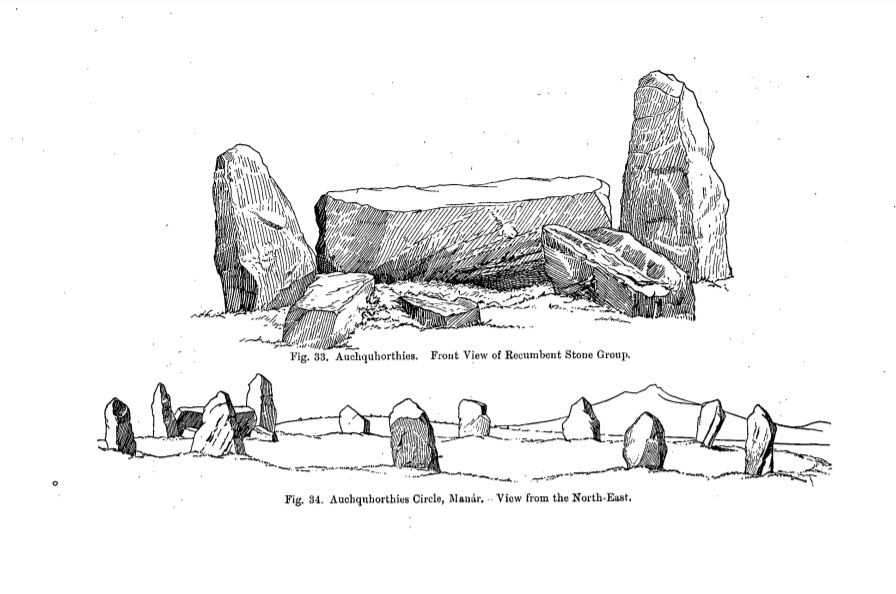
English: Easter Aquhorthies stone circle in a 1900 report of a detailed survey of the monument by Frederick Coles |
| Date | |
| Source | Coles, Frederick R. (1900). "Report on the Stone Circles of the North-East of Scotland, Inverurie District, obtained under the Gunning Fellowship, with Measured Plans and Drawings". Proceedings of the Society of Antiquaries of Scotland. 35: 187–248. Page 226 in particlular |
| Author | Frederick Coles (1854-1929) |
| Object location | | View this and other nearby images on: OpenStreetMap |
|---|
Licensing
This work is in the public domain in the United States because it was published (or registered with the U.S. Copyright Office) before January 1, 1929.
Public domain works must be out of copyright in both the United States and in the source country of the work in order to be hosted on the Commons. If the work is not a U.S. work, the file must have an additional copyright tag indicating the copyright status in the source country.
Note: This tag should not be used for sound recordings. |
|
The author died in 1929, so this work is in the public domain in its country of origin and other countries and areas where the copyright term is the author's life plus 80 years or fewer. This work is in the public domain in the United States because it was published (or registered with the U.S. Copyright Office) before January 1, 1929. | |
| This file has been identified as being free of known restrictions under copyright law, including all related and neighboring rights. | |
File history
Click on a date/time to view the file as it appeared at that time.
| Date/Time | Thumbnail | Dimensions | User | Comment | |
|---|---|---|---|---|---|
| current | 23:44, 9 February 2020 | | 896 × 594 (293 KB) | Thincat | User created page with UploadWizard |
File usage
The following pages on the English Wikipedia use this file (pages on other projects are not listed):
Global file usage
The following other wikis use this file:
- Usage on de.wikipedia.org