
File:Earlestown Town Hall - geograph.org.uk - 1221534.jpg
Size of this preview: 450 × 600 pixels. Other resolutions: 180 × 240 pixels | 480 × 640 pixels.
Original file (480 × 640 pixels, file size: 58 KB, MIME type: image/jpeg)
| This is a file from the Wikimedia Commons. Information from its description page there is shown below. Commons is a freely licensed media file repository. You can help. |
Summary
| Description |
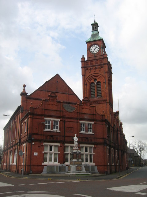
English: Earlestown Town Hall Earlestown owes its development to early transport links such as the nearby Sankey Canal and the Liverpool to Manchester railway. Wagon building works were established and other industries followed, the Sankey Sugar works and the Vickers Engineering works. By the 1890s, the Earlestown area of Newton-le-Willows had outgrown the older part of the town and the market was moved to its current location in the market square and the Town Hall was erected. |
| Date | |
| Source | From geograph.org.uk |
| Author | Sue Adair |
| Attribution (required by the license) | Sue Adair / Earlestown Town Hall / |
| Camera location | | View this and other nearby images on: OpenStreetMap |
|---|
_heading:315.00&language=en)
| Object location | | View this and other nearby images on: OpenStreetMap |
|---|
_heading:315.00&language=en)
Licensing

|
This image was taken from the Geograph project collection. See this photograph's page on the Geograph website for the photographer's contact details. The copyright on this image is owned by Sue Adair and is licensed for reuse under the Creative Commons Attribution-ShareAlike 2.0 license.
|
This file is licensed under the Creative Commons Attribution-Share Alike 2.0 Generic license.
Attribution: Sue Adair
- You are free:
- to share – to copy, distribute and transmit the work
- to remix – to adapt the work
- Under the following conditions:
- attribution – You must give appropriate credit, provide a link to the license, and indicate if changes were made. You may do so in any reasonable manner, but not in any way that suggests the licensor endorses you or your use.
- share alike – If you remix, transform, or build upon the material, you must distribute your contributions under the same or compatible license as the original.
File history
Click on a date/time to view the file as it appeared at that time.
| Date/Time | Thumbnail | Dimensions | User | Comment | |
|---|---|---|---|---|---|
| current | 09:39, 26 February 2011 | | 480 × 640 (58 KB) | GeographBot | == {{int:filedesc}} == {{Information |description={{en|1=Earlestown Town Hall Earlestown owes its development to early transport links such as the nearby Sankey Canal and the Liverpool to Manchester railway. Wagon building works were established and other |
File usage
The following pages on the English Wikipedia use this file (pages on other projects are not listed):