
File:Dronning Louises Bro 2012.jpg
Size of this preview: 800 × 600 pixels. Other resolutions: 320 × 240 pixels | 640 × 480 pixels | 1,024 × 768 pixels | 1,280 × 960 pixels | 2,560 × 1,920 pixels | 3,732 × 2,799 pixels.
Original file (3,732 × 2,799 pixels, file size: 2.65 MB, MIME type: image/jpeg)
| This is a file from the Wikimedia Commons. Information from its description page there is shown below. Commons is a freely licensed media file repository. You can help. |
Summary
| Description |
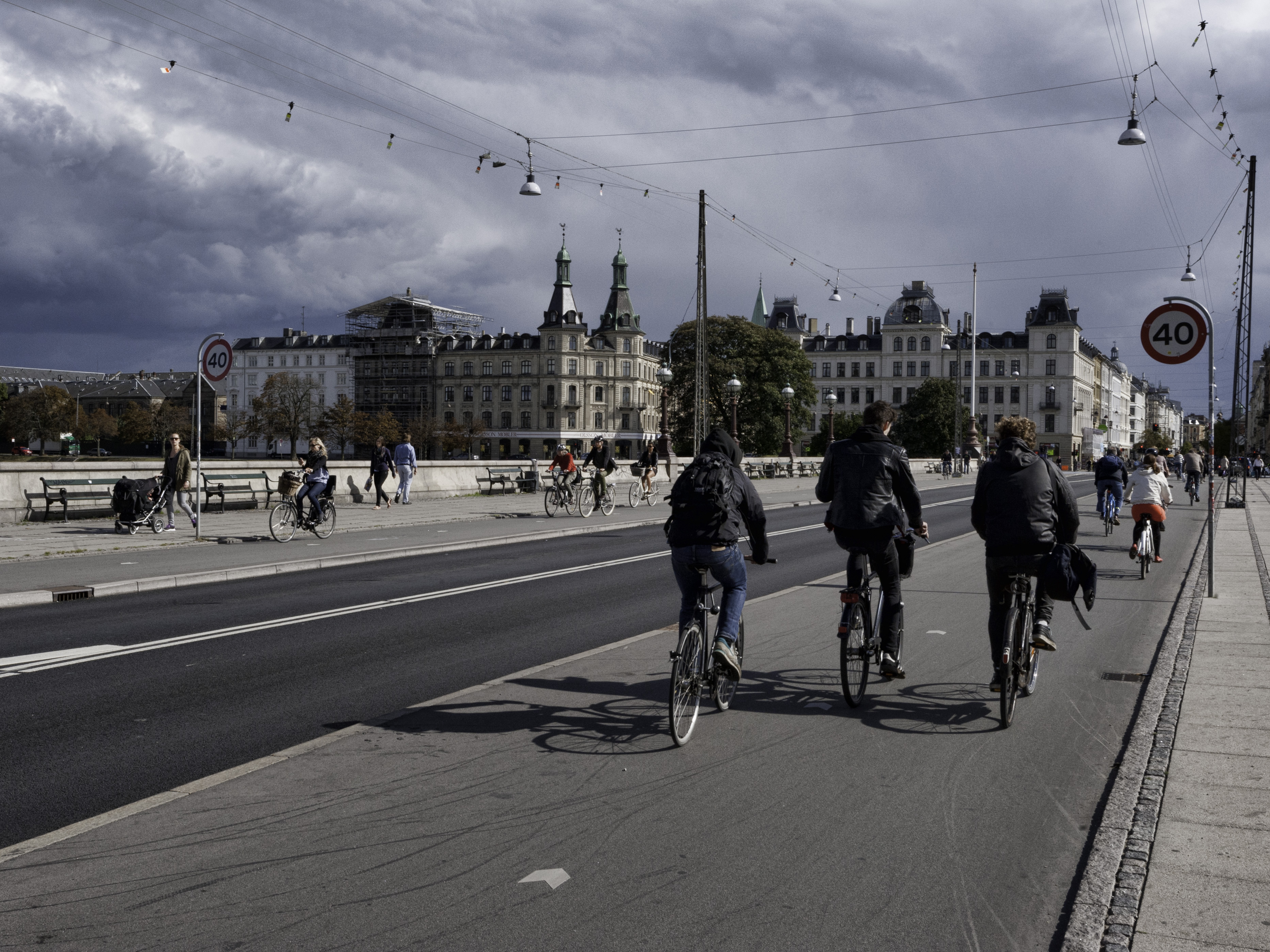
English: Dronning Louises Bro (lit.: Queen Louise's Bridge), summer 2012. The two wide bikeways was added early 2012 to improve biking. Dansk: Dronning Louises Bro sommeren 2012. De to brede cykelstier, blev tilføjet i starten af 2012, for at forbedre cykelforholdene. |
| Date | |
| Source | Own work |
| Author | heb@Wikimedia Commons (mail) |
| Permission (Reusing this file) |
Attribution (see license details below), to be credited with
|
| Camera location | | View this and other nearby images on: OpenStreetMap |
|---|
Non-copyright restrictions

|
Although this work is freely licensed or in the public domain, the person(s) shown may have rights that legally restrict certain re-uses unless those depicted consent to such uses. In these cases, a model release or other evidence of consent could protect you from infringement claims. Though not obliged to do so, the uploader may be able to help you to obtain such evidence. See our general disclaimer for more information. |
Licensing
This file is licensed under the Creative Commons Attribution-Share Alike 3.0 Unported license.
- You are free:
- to share – to copy, distribute and transmit the work
- to remix – to adapt the work
- Under the following conditions:
- attribution – You must give appropriate credit, provide a link to the license, and indicate if changes were made. You may do so in any reasonable manner, but not in any way that suggests the licensor endorses you or your use.
- share alike – If you remix, transform, or build upon the material, you must distribute your contributions under the same or compatible license as the original.
File history
Click on a date/time to view the file as it appeared at that time.
| Date/Time | Thumbnail | Dimensions | User | Comment | |
|---|---|---|---|---|---|
| current | 13:11, 24 March 2013 | | 3,732 × 2,799 (2.65 MB) | Heb | == {{int:filedesc}} == {{Information |Description={{en|''Dronning Louises Bro'' (lit.: ''Queen Louise's Bridge''), summer 2012. The two wide bikeways was added early 2012 to improve biking.}} {{da|''Dronning Louises Bro'' sommeren 2012. De to brede cyk... |
File usage
The following pages on the English Wikipedia use this file (pages on other projects are not listed):
Global file usage
The following other wikis use this file:
- Usage on ar.wikipedia.org
- Usage on de.wikivoyage.org
- Usage on en.wikivoyage.org
- Usage on id.wikipedia.org
- Usage on is.wikipedia.org
- Usage on no.wikipedia.org